
Latest SimActive Upgrade of Correlator3D™ Boosts Cloud Capabilities for Enhanced Productivity SimActive Inc., a global leader in photogrammetry software development, has announced significant enhancements to its Correlator3D™ software, aimed at improving productivity in cloud environments. The upgrade allows clients to effortlessly scale their processing in alignment with … [Read more...] about SimActive Enhances Cloud Productivity with Correlator3D Upgrade
photogrammetry
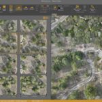
ALDOT Uses Drone Data and Correlator3D for Rapid Tornado Recovery

ALDOT Employs SimActive Software and Drone Imagery for Swift Tornado Recovery In the wake of a devastating tornado that swept through the southwest portion of Selma, Alabama, earlier this year, the Alabama Department of Transportation (ALDOT) turned to SimActive Inc., a renowned developer of photogrammetry software, to aid in the efficient assessment of the damage. Utilizing … [Read more...] about ALDOT Uses Drone Data and Correlator3D for Rapid Tornado Recovery
Virtual Surveyor Releases Newest Version of Smart Drone Surveying Software: Now with Photogrammetry
Virtual Surveyor Releases New Photogrammetry App: Completing Drone Survey Workflow Continue reading below, or listen: DroneLife · Virtual - Surveyor - Adds - Photogrammetry - To - Drone - Surveying - Package by DRONELIFE Staff Writer Ian M. Crosby Software company Virtual Surveyor has updated the newest version of its smart drone surveying software to include drone … [Read more...] about Virtual Surveyor Releases Newest Version of Smart Drone Surveying Software: Now with Photogrammetry
Microsoft Collaborates with SimActive to Demonstrate a Cloud Photogrammetry Solution

Microsoft Collaborates with SimActive on a Cloud Photogrammetry Solution Continue reading below, or listen: DroneLife · Microsoft - Collaborates - With - SimActive - On - Cloud - Photogrammetry - Solution Microsoft has announced a collaboration with Canada-based SimActive Inc., creators of the Correlator3D mapping platform, to demonstrate a cloud photogrammetry solution. … [Read more...] about Microsoft Collaborates with SimActive to Demonstrate a Cloud Photogrammetry Solution
DroneDeploy’s New Products Go Far Beyond Drones

DroneDeploy's New Products: company launches mapping, inspection and ground-based robot products By Jim Magill Drone software company DroneDeploy unveiled a suite of new products, allowing customers to virtually walk through construction sites, capture and process data across miles of pipelines or electric transmission lines, and control walking inspection robots from … [Read more...] about DroneDeploy’s New Products Go Far Beyond Drones


