
The Idaho-based UAV power supplier becomes the first major drone battery maker to operate full-scale production on two continents. Titan Batteries has opened its flagship European production facility in Tilburg, the Netherlands. The Pocatello, Idaho-based company announced the launch on May 2, 2026, International Drone Day. The new plant sits on the Energy Conversion Campus on … [Read more...] about Titan Batteries Opens European Drone Battery Plant in Tilburg
mapping drones
Another New Drone from ZenaTech
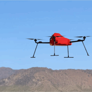
ZenaTech Launches ZenaDrone IQ Quad for Survey and Mapping Markets New autonomous quadcopter targets land surveying, construction, urban planning, and public works ZenaTech has announced the launch of the ZenaDrone IQ Quad, a new autonomous quadcopter designed for survey and mapping work. The drone will support land surveying, construction, urban planning, real estate … [Read more...] about Another New Drone from ZenaTech
Wingcopter 198 Drones to Support Aerial Surveying in Japan

Wingcopter’s long-range Wingcopter 198 drone will be deployed for aerial surveying in Japan under a new collaboration between ITOCHU Corporation, PASCO Corporation, and YellowScan Japan Co., Ltd. The partners have signed an MOU to apply the platform to disaster management, terrain mapping, and post-event restoration tasks. The Wingcopter 198 combines vertical takeoff and … [Read more...] about Wingcopter 198 Drones to Support Aerial Surveying in Japan
Orkid Unveils All-in-One Drone Combining LiDAR, Photogrammetry, GNSS, and Starlink

Orkid has announced a new variant of its ORKID 260 vertical take-off and landing (VTOL) drone, bringing together four of the most advanced aerial data capture technologies into one integrated, NDAA-compliant system. The ORKID 260VTOL integrated drone combines LiDAR, photogrammetry, GNSS, and Starlink satellite connectivity onboard, allowing all systems to operate … [Read more...] about Orkid Unveils All-in-One Drone Combining LiDAR, Photogrammetry, GNSS, and Starlink
From the Floor of Intergeo 2025: Phase One Unveils Advanced Drone Camera Systems

Phase One demonstrated comprehensive aerial imaging technologies at Intergeo 2025 in Frankfurt, showcasing new drone camera integration solutions designed for professional geospatial applications. The company announced hardware and software developments targeting surveying, inspection, and mapping operations across multiple UAV platforms. iXM-RS250 Aerial Camera Technical … [Read more...] about From the Floor of Intergeo 2025: Phase One Unveils Advanced Drone Camera Systems


