Editor’s note: All links to iptsat webs resources are translated via Google Translate. An Italian aerospace company has something valuable to offer European drone pilots – peace of mind. Iptsat Ltd, a GIS satellite company dedicated to cartography and UAV mapping, has deployed a SAPR mapping solution which allows drone users flying over Italian territories to have access … [Read more...] about Italian GIS system Sheds Light on National Drone Landscape
Mapbox
5 Projects Putting Drones on the Map
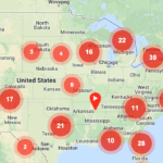
Just as UAV technology has spawned a new wave of innovative engineering, several recent initiatives are starting to harness the impending data-boom that will emanate from our increasingly crowded skies. Because there is no RMV for drones (yet), several privately owned websites are looking to get into the game early by creating communities and information hubs to … [Read more...] about 5 Projects Putting Drones on the Map
Check This Map Before You Fly Your Drone
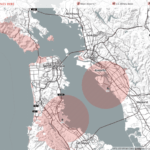
from Wired The popularity of drones is climbing quickly among companies, governments and citizens alike. But the rules surrounding where, when and why you can fly an unmanned aerial vehicle aren’t very clear. The FAA has tried to assert control and insist on licensing for all drone operators, while drone pilots and some legal experts claim drones do not fall under the FAA’s … [Read more...] about Check This Map Before You Fly Your Drone


