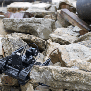
New integration brings LiDAR mapping and radiation detection together across air and ground platforms Teledyne FLIR Defense has expanded its Third-Party Payload Integration Program with the addition of Emesent’s Hovermap LiDAR payload. Announced at Modern Day Marine 2026, the certification allows the Hovermap system to operate across Teledyne FLIR’s unmanned aerial systems … [Read more...] about Teledyne FLIR Defense Expands Payload Program with Emesent Hovermap for GPS-Denied Operations
LiDAR drones
Another New Drone from ZenaTech
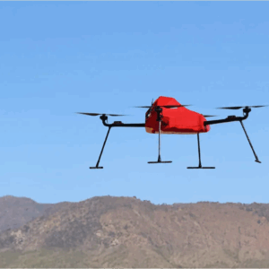
ZenaTech Launches ZenaDrone IQ Quad for Survey and Mapping Markets New autonomous quadcopter targets land surveying, construction, urban planning, and public works ZenaTech has announced the launch of the ZenaDrone IQ Quad, a new autonomous quadcopter designed for survey and mapping work. The drone will support land surveying, construction, urban planning, real estate … [Read more...] about Another New Drone from ZenaTech
Nokia Upgrades 5G Drone Platform With Amprius SiCore Batteries
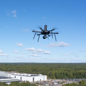
New power system supports longer flights, heavier payloads, and mission-critical operations Nokia has announced a major upgrade to its 5G drone platform with the integration of Amprius’ SiCore® batteries. The change follows a full qualification and testing process and responds to rising industry demand for drones that can fly longer, carry more advanced sensors, and operate as … [Read more...] about Nokia Upgrades 5G Drone Platform With Amprius SiCore Batteries
Wingcopter Secures New Funding and Strengthens Leadership Team

Fresh capital and new executives set to boost global drone operations Wingcopter, a leading German drone technology company, secures new funding from Copenhagen-based Nordic Secondary Fund, as well as existing shareholders and the European Investment Bank. The latest investment will support Wingcopter’s growth, including progress toward type certification for delivery drones … [Read more...] about Wingcopter Secures New Funding and Strengthens Leadership Team
NDAA-Compliant LiDAR Drone Surveying System: Microdrones New EasyOne Solution
Microdrones Reveals First NDAA-Compliant LiDAR Drone Surveying System At Commercial UAV Expo in Vegas last week, Microdrones announced their new, NDAA-compliant EasyOne LiDAR solution. The solution was also on show at the nighttime, CSI demonstration hosted by Sundance Media Group: where the Microdrones solution executed a grid mission in moments to produce a digital twin of … [Read more...] about NDAA-Compliant LiDAR Drone Surveying System: Microdrones New EasyOne Solution


