
SimActive Accelerates Point Cloud Generation with new version if Correlator 3D: 10.1 SimActive Inc., a world-leading developer of photogrammetry software, isn't slowing down. The company recently celebrated their 20th anniversary with the launch of Correlator 3D v. 10, with new features and an undated interface. Now, SimActive announces the release of Correlator3D Version … [Read more...] about SimActive Releases New Version of Correlator 3D: Point Clouds and DSMs, Generated Twice as Fast
Correlator 3D
Are Drones Always the Best Tool for the Job? Beacon Aviation Reduces Mapping Costs with SimActive
Integration of SimActive Photogrammetry Software Reduces Mapping Costs by DRONELIFE Staff Writer Ian M. Crosby Software developer SimActive has announced that its Correlator3D photogrammetry solution is to be utilized by Beacon Aviation, Inc. in order to lower costs required for mapping projects. Beacon, which operates throughout the Midwest, conducts mapping projects for … [Read more...] about Are Drones Always the Best Tool for the Job? Beacon Aviation Reduces Mapping Costs with SimActive
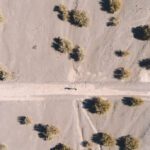
Drone Mapping in Construction: SimActive’s Correlator 3D in the Field in Texas
Drone mapping in construction can provide construction firms with the data they need to make profitable decisions. Chasco Constructors started in Round Rock, TX as a 4-man shop: but today, Chasco is an award winning, full service commercial construction company with over 300 employees. They're using cutting edge technology, including drones and mapping, to monitor … [Read more...] about Drone Mapping in Construction: SimActive’s Correlator 3D in the Field in Texas
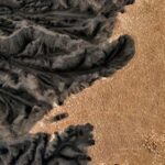
The Right Tools for Oil and Gas Exploration: SimActive and Dawson Geophysical
Canada's SimActive and Dawson Geophysical demonstrate the use of drones with mapping and modeling software for oil and gas seismic exploration. Knowing where to drill is a million dollar question for the oil and gas industry. Seismic exploration is one way that the energy industry can determine where commercially viable energy stores are to be found. From Oil and Gas … [Read more...] about The Right Tools for Oil and Gas Exploration: SimActive and Dawson Geophysical
SimActive Introduces Cloud Sharing and Reflectance Calibration
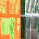
Montreal, Canada, June 9th, 2020 – SimActive Inc., a world-leading developer of photogrammetry software, announces the release of Correlator3D version 8.5. The new version allows users to share and visualize projects in the cloud. It also features new tools for the calibration and processing of multispectral imagery. Specifically, results can be exported to the cloud … [Read more...] about SimActive Introduces Cloud Sharing and Reflectance Calibration


