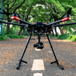
Announced this week and rolling out in Commercial UAV Expo later this month, professional gimbal maker Gremsy, has just announced the Pixy U Gimbal. It is a commercial grade gimbal that is designed for aerial surveying and other commercial drone applications. It builds upon the existing product line that includes the Pixy F and shares its compact design and performance but … [Read more...] about Meet the New Gremsy Gimbal: The Pixy U Plays Well With Others
Agriculture
Commercial Drones FM: Multi Spectral Drone Cameras for Precision Agriculture [Podcast]

Ian Smith of Commercial Drones FM speaks with Drew Baustian, Business Development Manager at MicaSense, to explain the finer points of multispectral drone cameras and imagery for precision agriculture. The pair discuss data capture, the science behind the tech, and use cases where multispectral imagery has been a difference-maker for agriculture end users. MicaSense recently … [Read more...] about Commercial Drones FM: Multi Spectral Drone Cameras for Precision Agriculture [Podcast]
Delair and Geosys Partner on Precision Agriculture
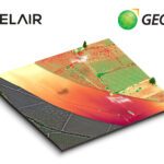
French enterprise drone manufacturer and aerial data provider Delair and Geosys, a specialist in satellite and weather data analytics for agriculture, have announced a partnership to expand data gathering and analysis in precision farming. The result of the partnership will be a single analytics platform that integrates drone and satellite data for agriculture companies … [Read more...] about Delair and Geosys Partner on Precision Agriculture
Tom Walker Has One Major Message for the Drone Industry
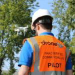
At last week's InterDrone Conference, DroneUp CEO Tom Walker delivered a clear message to the drone industry: the time to make money and provide services is now. Don't wait for regulation, don't wait for industry maturity - but focus on the opportunities available today, because there are plenty of them out there. Walker is the founder and CEO of DroneUp, a comprehensive … [Read more...] about Tom Walker Has One Major Message for the Drone Industry
Can Drones Compete with Satellite Images? How BVLOS Will Change Global Agriculture
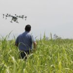
At this week's InterDrone conference in Las Vegas, Michael Ritter of SlantRange gave a great presentation - and explained how drones may be able to completely revolutionize global agriculture. Imagine aerial data that can tell you much, much more than which areas of your fields are planted and relatively healthy or the standard analysis received from comparing crops to … [Read more...] about Can Drones Compete with Satellite Images? How BVLOS Will Change Global Agriculture


