A French-based drone provider just piloted its way into a lucrative funding round with the world’s largest processor giant. Commercial drone solution provider Delair closed an expanded investment deal with Intel Capital, following a year of collaboration on the Intel Insight Platform. The cloud-based, digital-asset management system will allow Intel to optimize data … [Read more...] about Delair Leverages Intel Funding with Drone Data Platform
Imaging
Insitu’s Photogrammetry Payload Pushes Theoretical Limits of Accuracy

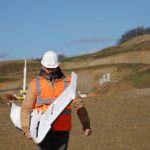
Boeing subsidiary Insitu has revealed that its latest advancements in High Accuracy Photogrammetry (HAP) are pushing the theoretical limits of aerial photography at altitude. Last month Insitu’s latest prototype carried a HAP payload that can capture images accurate to within five centimeters (cm) horizontally and 10cm vertically. Insitu describes this new capability as … [Read more...] about Insitu’s Photogrammetry Payload Pushes Theoretical Limits of Accuracy
Check Out the Winning Videos of the Month from AirVuz!

AirVuz has a new feature on their site. They're offering prizes to the best drone videos uploaded each week - and at the end of the month, they select one of the weekly winners for another prize. If you've got a drone video to share, consider uploading - and to see a selection of incredible drone footage, check out this contest video! … [Read more...] about Check Out the Winning Videos of the Month from AirVuz!
Report: Drone Mapping is Getting Bigger, Smarter and Popular

In January, drone software platform DroneDeploy “talked the talk,” offering several predictions about the UAV sector for 2018. Now, the company is “walking the walk” with an in-depth industry report. The San Francisco-based firm this week released a 14-page report outlining major trends based on customer data from 180 nations. Key Findings Among DroneDeploy customers, … [Read more...] about Report: Drone Mapping is Getting Bigger, Smarter and Popular
Wingtra’s New Drone Sets Benchmark in Precision Mapping
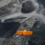
Swiss drone manufacturer Wingtra this week announced the launch of the WingtraOne PPK (Post-Processed Kinematics) model. Working with photogrammetry software provider Pix4D and PPK provider Septentrio, the company says it can now provide orthomosaics mapping and 3D models “with an absolute accuracy down to .4 inches.” Several industry sectors – mining, construction, … [Read more...] about Wingtra’s New Drone Sets Benchmark in Precision Mapping


