• Skip to main content
  • Skip to secondary menu
  • Skip to primary sidebar
  • Skip to secondary sidebar
  • Skip to footer
  • DroneRacingLife
  • DroneFlyers
  • Newsletter
DroneLife

DRONELIFE

Stay up to date on all the latest Drone News

  • News
  • Products
  • Industries
    • Agriculture
    • Construction
    • Delivery
    • Dual Use
    • Inspection
    • Public Safety
    • Surveying
  • Enthusiasts
  • Regulations
  • Business
  • Video
  • Podcasts

Wingtra’s New Drone Sets Benchmark in Precision Mapping

March 1, 2018 by Jason Reagan 4 Comments

Swiss drone manufacturer Wingtra this week announced the launch of the WingtraOne PPK (Post-Processed Kinematics) model. Working with photogrammetry software provider Pix4D and PPK provider Septentrio, the company says it can now provide orthomosaics mapping and 3D models “with an absolute accuracy down to .4 inches.”

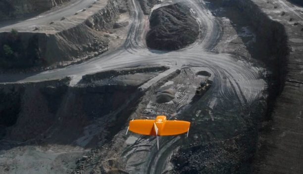
Several industry sectors – mining, construction, surveying and telecommunications – rely on aerial mapping and 3D modeling to diagnose problem areas or survey terrain for expansion of new projects.  Deploying drones provides a cheaper and safer option over manned flight.

The WingtraOne PPK is a hybrid drone – a combination of fixed-wing and multi-rotor – and launches as a vertical take-off and landing aircraft.

“Vertical take-off and landing means hands-free operation and a smoother ride for the on-board sensors,” CTO of Wingtra CTO Armin Ambühl said in a press release. “Secondly, efficient flying in fixed-wing mode means far greater coverage than any comparable multirotor.”

Ambühl added that the new model can cover 320 acres in a one-hour flight – about 240 football fields. Explaining PPK, he explained: “PPK computes ultra-precise geolocations for each image by combining the GNSS data with correction data from a nearby reference receiver.”

“Our unique VTOL technology has already helped us establish a firm ground in the market with applications ranging from cadastral surveying of Africa’s largest Uranium mine to digital elevation modelling of Alpine locations,” COO Maximilian Boosfeld said.

“With the combination of VTOL capability and the PPK, we see a clear advantage over the current aerial surveying solutions. I believe that WingtraOne will generally replace fixed-wings in large coverage mapping missions in the near future as we have just set the new industry benchmark in drone photogrammetry.”

In September, the company partnered with data-imagery distributor Precision Capture to expand Wingtra’s U.S. market footprint.

Earlier this year, Swiss engineering firm Cavigelli Ingeniuere AG hired Wingtra to map Lumnezia, a Swiss Alpine valley, ahead of plans to install a 20-turbine wind farm in the remote, often inaccessible region.

“The transport, the flight preparation, the flight planning, the takeoff process, and the data transfer were very easy and convincing [sic],” Cavigelli engineer Thomas Arpagaus said of the project. “Thanks to the use of a drone, we were able to greatly reduce the costs for the surveying and evaluation of the original site for the design work. The tight project planning could be kept due to the fast and flexible data acquisition.”

Jason Reagan
Jason Reagan

Jason is a longstanding contributor to DroneLife with an avid interest in all things tech. He focuses on anti-drone technologies and the public safety sector; police, fire, and search and rescue.

Beginning his career as a journalist in 1996, Jason has since written and edited thousands of engaging news articles, blog posts, press releases and online content.

Email Jason
TWITTER:@JasonPReagan

LinkedIn 

Subscribe to DroneLife here.

Filed Under: Drone News, Drone News Feeds, Imaging, News Tagged With: 3d mapping, orthomosaics, Wingtra

Reader Interactions

Trackbacks

  1. Police to be armed with 'drone guns' during the Commonwealth Games | Drone "Ki" says:
    April 1, 2018 at 12:56 am

    […] Swiss drone manufacturer Wingtra this week announced the launch of the WingtraOne PPK (Post-Processed Kinematics) model. Working with photogrammetry software provider Pix4D and PPK provider Septentrio, the company says it can now provide orthomosaics mapping and 3D models “with an absolute accuracy down to .4 inches.” Several industry sectors – mining, construction, surveying and telecommunications […] The post Wingtra’s New Drone Sets Benchmark in Precision Mapping appeared first on DSee Original Article […]

    Reply
  2. WingtraOne PPK: este dron mapea 240 campos de fútbol en una hora – Amigos del Dron says:
    March 7, 2018 at 1:45 am

    […] El nuevo dron trabaja con el proveedor de software de fotogametría Pix4D y el proveedor de tecnología PPK Septentrio, con el fin de crear ortofotos exactas. Wingtra también se ha asociado con Precision Capture, especialista en extraer datos de las imágenes. […]

    Reply
  3. Wingtra’s New Drone Sets Benchmark in Precision Mapping | Drone Magazine says:
    March 1, 2018 at 5:16 pm

    […] Source […]

    Reply
  4. Wingtra’s New Drone Sets Benchmark in Precision Mapping – Drones Crunch says:
    March 1, 2018 at 12:15 pm

    […] DRONELIFE […]

    Reply

Leave a Reply Cancel reply

Your email address will not be published. Required fields are marked *

Primary Sidebar

LATEST

5 Federal Drone Policies Flying Under the Radar This Summer

From World Cup airspace restrictions to critical infrastructure rulemaking, several federal initiatives could shape the drone industry in the months…

Continue Reading 5 Federal Drone Policies Flying Under the Radar This Summer

Drone Industry Insights Launches the 9th Edition of the Global Drone Survey — The World’s Largest Annual Industry Survey for the Drone Market

Survey open to all actors in the global drone market ecosystem — manufacturers, operators, investors, associations, regulators, and service providers…

Continue Reading Drone Industry Insights Launches the 9th Edition of the Global Drone Survey — The World’s Largest Annual Industry Survey for the Drone Market

Proposed Patent Bill Could Have Major Implications for Drone Industry Intellectual Property

Prohibiting Adversarial Patents Act would make certain patents unenforceable while leaving ownership intact A newly introduced bill in Congress concerning…

Continue Reading Proposed Patent Bill Could Have Major Implications for Drone Industry Intellectual Property

Seattle Stadium “No-Drone Zone” During FIFA Matches

By Dronelife Features Editor Jim Magill Federal officials on Monday urged drone operators to stay away from Lumen Field, which…

Continue Reading Seattle Stadium “No-Drone Zone” During FIFA Matches

Landair Surveys Uses SimActive Correlator3D for Planned Burns Mapping in Australia

The Australian geospatial firm is using Correlator3D to generate orthomosaics from aerial imagery captured for wildfire prevention and land management…

Continue Reading Landair Surveys Uses SimActive Correlator3D for Planned Burns Mapping in Australia

As Disaster Risks Grow, WingXpand and Verizon Explore New Tools for Emergency Response

WingXpand will work with Verizon Frontline and emergency teams to explore new tools for disaster assessment and community resilience As…

Continue Reading As Disaster Risks Grow, WingXpand and Verizon Explore New Tools for Emergency Response

HOVERAir’s UK Launch Raises a Bigger Question: Who Will Serve America’s Consumer Drone Market?

HOVERAir has announced the UK launch of its new X1 Smart, a 99-gram self-flying camera designed to make aerial content…

Continue Reading HOVERAir’s UK Launch Raises a Bigger Question: Who Will Serve America’s Consumer Drone Market?

DRONELIFE Exclusive Interview: Inside PDW’s Strategy to Build Drones That Can Operate When GPS and Communications Fail

PDW works to develop advanced drone communications systems By DRONELIFE Features Editor Jim Magill As modern warfare increasingly relies on…

Continue Reading DRONELIFE Exclusive Interview: Inside PDW’s Strategy to Build Drones That Can Operate When GPS and Communications Fail

AirData UAV and LeoSight Bring Live Drone Data for DFR Programs

The new LeoSight AirData integration streams real-time flight data, telemetry, and operational insights from AirData directly into LeoCommand, giving dispatchers…

Continue Reading AirData UAV and LeoSight Bring Live Drone Data for DFR Programs

New Boson SX8 Brings High-Resolution Thermal Imaging to NDAA-Compliant Drone Payloads

New thermal imaging module combines SXGA resolution with compact size and U.S. manufacturing Teledyne FLIR OEM has announced the Boson…

Continue Reading New Boson SX8 Brings High-Resolution Thermal Imaging to NDAA-Compliant Drone Payloads

Secondary Sidebar

Footer

SPONSORED

Inspired Flight Gremsy IF800 VIO F1 drones geo week

What Will It Take to Strengthen U.S. Drone Manufacturing? A Conversation with Inspired Flight’s CEO

Global Mapper Mobile data collection

Collection Ground Control Points with Global Mapper Mobile

Military Drone Mapping Solutions

How SimActive’s Correlator3D™ is Revolutionizing Military Mapping: An Exclusive Interview with CEO Philippe Simard

Photogrammetry Accuracy Standards

SimActive Photogrammetry Software: Enabling Users to Meet Accuracy Standards for Over 20 Years

NACT Engineering Parrot ANAFI tether indoor shot

Smart Tether for Parrot ANAFI USA from NACT Engineering

Blue Marble, features global mapper, features Blue Marble

Check Out These New Features in Global Mapper v25 from Blue Marble

About Us | Contact Us | Advertise With Us | Write for Us | Privacy Policy | Terms of Service

The Trusted Source for the Business of Drones.

This website uses cookies and third party services. By clicking OK, you are agreeing to our privacy policy. ACCEPT

Manage consent

Privacy Overview

This website uses cookies to improve your experience while you navigate through the website. Out of these, the cookies that are categorized as necessary are stored on your browser as they are essential for the working of basic functionalities of the website. We also use third-party cookies that help us analyze and understand how you use this website. These cookies will be stored in your browser only with your consent. You also have the option to opt-out of these cookies. But opting out of some of these cookies may affect your browsing experience.
Necessary
Always Enabled
Necessary cookies are absolutely essential for the website to function properly. These cookies ensure basic functionalities and security features of the website, anonymously.
CookieDurationDescription
cookielawinfo-checkbox-analytics11 monthsThis cookie is set by GDPR Cookie Consent plugin. The cookie is used to store the user consent for the cookies in the category "Analytics".
cookielawinfo-checkbox-functional11 monthsThe cookie is set by GDPR cookie consent to record the user consent for the cookies in the category "Functional".
cookielawinfo-checkbox-necessary11 monthsThis cookie is set by GDPR Cookie Consent plugin. The cookies is used to store the user consent for the cookies in the category "Necessary".
cookielawinfo-checkbox-others11 monthsThis cookie is set by GDPR Cookie Consent plugin. The cookie is used to store the user consent for the cookies in the category "Other.
cookielawinfo-checkbox-performance11 monthsThis cookie is set by GDPR Cookie Consent plugin. The cookie is used to store the user consent for the cookies in the category "Performance".
viewed_cookie_policy11 monthsThe cookie is set by the GDPR Cookie Consent plugin and is used to store whether or not user has consented to the use of cookies. It does not store any personal data.
Functional
Functional cookies help to perform certain functionalities like sharing the content of the website on social media platforms, collect feedbacks, and other third-party features.
Performance
Performance cookies are used to understand and analyze the key performance indexes of the website which helps in delivering a better user experience for the visitors.
Analytics
Analytical cookies are used to understand how visitors interact with the website. These cookies help provide information on metrics the number of visitors, bounce rate, traffic source, etc.
Advertisement
Advertisement cookies are used to provide visitors with relevant ads and marketing campaigns. These cookies track visitors across websites and collect information to provide customized ads.
Others
Other uncategorized cookies are those that are being analyzed and have not been classified into a category as yet.
SAVE & ACCEPT