
Shenzen-based, Chinese UAV provider Geneinno Technology has appointed Drone Solutions as the company’s new tech distributor for Southeast Asia. The Singaporean company will market, sell and provide after-sales service for Geneinno’s underwater drones with an emphasis on the Poseidon model. According to a company release, Poseidon features deep dive capabilities, WIFI … [Read more...] about Drone Solutions Partners with Chinese Aqua Drone Firm
Imaging
New TeAx Add-on Improves Drone thermal Surveys
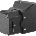
We talk about how cool drones are all the time…right? But did you ever think about the technology that hangs under a drone -- hardware that delivers awesome data and superior telemetry? German thermal-imaging company TeAx Technology is one of many such companies that often perform the unsung “heavy lifting” when it comes to drone-data delivery. The company recently … [Read more...] about New TeAx Add-on Improves Drone thermal Surveys
Terra For Drone Software Vendors as DJI Launches Mapping & Modeling Tool
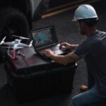
Not that many years ago, DJI was credited with forcing several competitors to pivot out of the drone hardware market and into commercial software. The Chinese company's drones were too good and too cheap for the likes of 3DR to compete with. Now the world's leading manufacturer has launched Terra, a new software tool that transforms drone data into 3D models and maps … [Read more...] about Terra For Drone Software Vendors as DJI Launches Mapping & Modeling Tool
50 Ways to Love Your LiDAR: How LiDAR is Used in Commercial Drone Applications

LiDAR is one of the most important tools in the commercial drone industry. While it has been around since the 1960s when it was mounted to aircraft, its uses have expanded dramatically now that LiDAR can be used with commercial drones. What is LiDAR and how does it work? LiDAR is a remote sensing technology: sensors that are mounted to drones send a pulse from a laser … [Read more...] about 50 Ways to Love Your LiDAR: How LiDAR is Used in Commercial Drone Applications
Astigan: Ordnance Survey To Launch High-Altitude, Solar-Powered Mapping Drone

National mapping agency for Great Britain and leading geospatial data organization Ordnance Survey (OS) has announced plans to launch a solar-powered drone that will fly at high altitude to complement existing satellite mapping systems. The aim of the High Altitude Psuedo Satellite (HAPS) project, called Astigan, is to provide faster, higher quality images of Earth from … [Read more...] about Astigan: Ordnance Survey To Launch High-Altitude, Solar-Powered Mapping Drone


