 Streamline Data Collection and Processing with Global Mapper Mobile
By Amanda Lind
The following article is sponsored content.
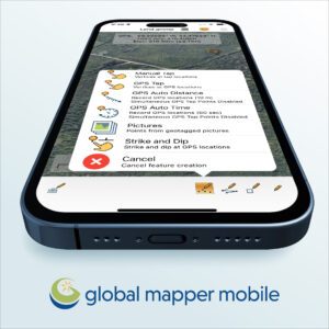
Streamline your field-to-office workflow by taking advantage of Global Mapper Mobile’s ability to collect high-accuracy vector data in the field.
Continue reading below, or listen:
Available on iOS and Android systems, Global Mapper Mobile allows data to be brought to and from the field for reference, augmentation, and new data collection. The Pro version of Global Mapper Mobile, available with an annual subscription, improves functionality with additional support for external GPS device connections, expanded online data streaming sources, on-the-go terrain processing, and more.
Data collected with Global Mapper Mobile, such as ground control points, can be easily transferred to the desktop version of Global Mapper. Once imported, easily process the field-collected data with a wide variety of tools, including the photogrammetric processing tool, Pixels to Points. Drone data can be imported into Pixels to Points, along with optional ground control points, to create ortho images, 3D Mesh layers, and point clouds from collected overlapping images.
For more accurate data collection, you can connect your mobile device to an external GPS unit. Originally, Global Mapper Mobile only supported connections via Bluetooth, but recent releases have expanded to include support for GNSS Devices via TCP/IP communication. Version 2.4 of Global Mapper Mobile supports various device types for iOS and Android, including Trimble, Bad Elf, Javad, Emild, and others.
Global Mapper Mobile Pro also supports streaming multiple types of maps and online data sources directly to your device. These layers can be used for visual references, such as topo maps and imagery, or in tandem with elevation data. Online data sources, or data layers imported from the desktop version of Global Mapper, can also be used with the built-in terrain processing tools. These portable versions of Global Mapper desktop’s extensive terrain toolset can add elevation data to collected vector data from loaded terrain layers or calculate volume. You can measure the terrain volume within an area from the palm of your hand by calculating it either above or below ground. Multiple calculation methods are available to provide flexibility for your specific use case. In addition, the Viewshed tool can use elevation layers to asses spatial perspective from a location or even help identify landscapes in the distance.
Global Mapper Mobile v2.4 is now available for download with exciting new free and Pro features. Download the free version app from the iOS App Store or Google Play Store today!
Read more:
- From the Floor of Intergeo: Blue Marble Global Mapper V24, More Resolution, More Speed
- Global Mapper Mobile: New GNSS Device Support
- Drone Mapping: Global Mapper Mobile New Features Mean Higher Accuracy Data Collection

Miriam McNabb is the Editor-in-Chief of DRONELIFE and CEO of JobForDrones, a professional drone services marketplace, and a fascinated observer of the emerging drone industry and the regulatory environment for drones. Miriam has penned over 3,000 articles focused on the commercial drone space and is an international speaker and recognized figure in the industry. Miriam has a degree from the University of Chicago and over 20 years of experience in high tech sales and marketing for new technologies.
For drone industry consulting or writing, Email Miriam.
TWITTER:@spaldingbarker
Subscribe to DroneLife here.


[…] post Global Mapper Mobile: Streamlining Data Collection and Processing appeared first on […]