• Skip to main content
  • Skip to secondary menu
  • Skip to primary sidebar
  • Skip to secondary sidebar
  • Skip to footer
  • DroneRacingLife
  • DroneFlyers
  • Newsletter
DroneLife

DRONELIFE

Stay up to date on all the latest Drone News

  • News
  • Products
  • Industries
    • Agriculture
    • Construction
    • Delivery
    • Dual Use
    • Inspection
    • Public Safety
    • Surveying
  • Enthusiasts
  • Regulations
  • Business
  • Video
  • Podcasts

Urban UAV Operations Need More than Drones

May 15, 2026 by Miriam McNabb 1 Comment

Cloud Century has implemented more than 200 drone docks in China, learning what urban drone operations require. In this guest post, Cloud Century’s Meng Xu says the future low-altitude economy depends on infrastructure, autonomous operations, drone docks, and AI-assisted operational intelligence. DRONELIFE does not accept or make payment for guest posts.

Urban UAV Operations Need More Than Drones: They Need Infrastructure

As the global low-altitude economy continues to develop, the drone industry is evolving from isolated aircraft applications toward urban-scale operational systems.

According to Meng Xu, Head of R&D and Chief System Architect at Cloud Century, the future challenge of the low-altitude economy is no longer simply getting drones into the air, but building infrastructure capable of supporting stable, long-term autonomous operations.

From Isolated Flights to Urban Operational Networks

Xu believes many UAV systems still rely heavily on manual scheduling and isolated workflows. While this may work for small-scale deployments, it becomes increasinglydifficult to scale when drones begin supporting urban inspection, environmental monitoring, emergency response, and smart city operations.

“That’s why the industry’s focus must gradually shift from aircraft themselves to the infrastructure layer behind them,” Xu explains.

Compared with individual drone capabilities, large-scale urban UAV operations depend far more heavily on operational continuity, airspace coordination, and system-level collaboration.

Drone Docks as Infrastructure Nodes

Over the past several years, Cloud Century has deployed more than 200 unattended drone dock systems.

In Qingdao’s Laoshan District, the company participated in building a district-wide low-altitude operational network consisting of 44 unattended drone dock systems. These systems have operated continuously for more than four years and currently support over 10,000 UAV missions annually.The systems are used in urban inspection, environmental monitoring, emergency response, and smart governance.
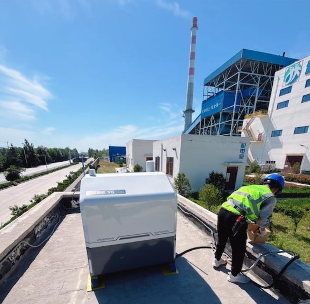
“Drone docks transform UAVs from standalone devices into persistent infrastructure nodes,” says Xu.

Industry observers note that while many UAV deployments globally still remain at the pilot-project stage, long-term unattended urban UAV infrastructure operating continuously at scale remains relatively uncommon.

The Real Challenge Is No Longer Flight — It Is Operations

As UAV systems continue scaling, Xu believes the real challenge is no longer flight itself, but maintaining stable operations in complex urban environments.

Real-world deployments are far more complicated than controlled testing environments. UAV systems must continuously operate despite GPS interference, communication instability, dense urban structures, dynamic airspace conditions, and persistent scheduling demands.

“Once systems reach a certain scale, the real challenge becomes operations,” Xu says.

Xu’s team focuses heavily on dynamic airspace adaptation, intelligent route replanning, remote diagnostics, and multi-UAV coordination. He also believes future low-altitude infrastructure will increasingly depend on AI-assisted operational intelligence capable of combining visual perception, telemetry data, environmental awareness, and operational events into real-time decision-making workflows.

The team has explored AI-assisted capabilities including multimodal scene recognition, intelligent event analysis, operational anomaly detection, and autonomous aerial lighting coordination for emergency-response scenarios.

“Future autonomous UAV systems will require more than automation. They will require operational intelligence capable of understanding complex environments and coordinating system-level responses.”

Xu also believes future autonomous operational systems will increasingly rely on agent-based coordination between UAVs, docking infrastructure, and sensing platforms operating under continuously changing environments.

Remote ID and Low-Altitude Safety Infrastructure

As low-altitude operational density continues to increase, airspace awareness is becoming increasingly important.

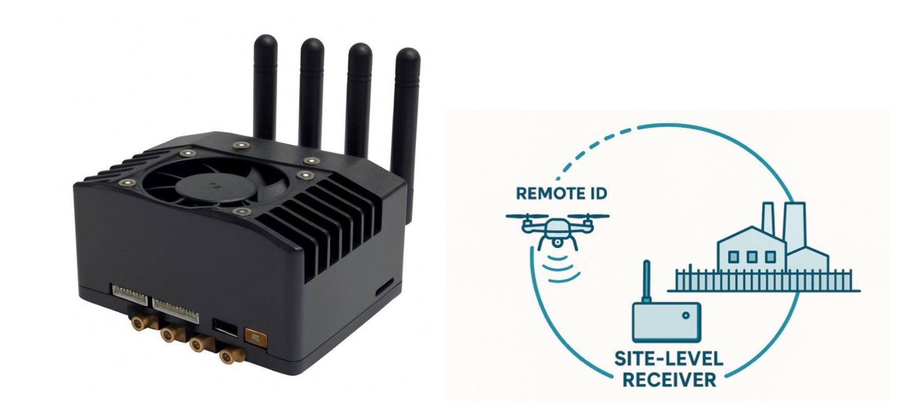
To support localized low-altitude awareness, Xu’s team integrated Remote ID-based detection and monitoring capabilities into its systems and continues researching the role of Remote ID in site-level low-altitude safety systems.

Beyond airspace awareness, Xu believes large-scale autonomous UAV infrastructure cannot rely entirely on a single positioning link or communication channel. To address this, his team developed an independent UAV recovery module capable of supporting drone location and retrieval during communication or positioning failures.
Precision Landing and the Next Phase of Infrastructure

Within unattended operational systems, precision landing remains one of the most important enabling technologies.Xu’s team developed a vision-assisted precision landing system capable of achieving approximately 99.5 percent landing success rates in real-world environments.

Looking ahead, Xu believes AI-enabled autonomous infrastructure will become increasingly important in large-area operational environments where human coverage is limited — particularly in scenarios such as remote infrastructure inspection, environmental monitoring, disaster management, and emergency response.

“The next phase of the industry will not simply be defined by more advanced drones. It will be defined by smarter, more stable, and more sustainable low-altitude operational infrastructure.”

Meng Xu, IEEE Senior Member, is the Head of R&D and Chief System Architect at Qingdao Cloud Century Information Technology Co., Ltd., leading the development of city-scale autonomous UAV platforms and drone dock systems. He specializes in large-scale UAV deployment, precision landing, dynamic geo-fencing, multi-vendor integration, and AI-based perception for real-world UAV operations. Meng has contributed peer-reviewed IEEE publications, international conference presentations, and multiple patents in UAV safety and autonomous systems.


Read more:

  • Inside the Coachella Valley’s Plan to Centralize Drone First Responder Operations
  • Beijing’s Drone Ban Goes Into Effect Today: A New Model for Urban UAV Control
  • Michigan’s Bet on the Low Altitude Economy: How M Air Connects Aerospace Innovation and Detroit Manufacturing

Miriam McNabb

Miriam McNabb is the Editor-in-Chief of DRONELIFE and CEO of JobForDrones, a professional drone services marketplace, and a fascinated observer of the emerging drone industry and the regulatory environment for drones. Miriam has penned over 3,000 articles focused on the commercial drone space and is an international speaker and recognized figure in the industry.  Miriam has a degree from the University of Chicago and over 20 years of experience in high tech sales and marketing for new technologies.
For drone industry consulting or writing, Email Miriam.

TWITTER:@spaldingbarker

Subscribe to DroneLife here.
Filed Under: Applications, DL Exclusive, Drone News, Drone News Feeds, News, Research Tagged With: AI-assisted operations, autonomous drone operations, autonomous UAV systems, Cloud Century, Drone Dock Systems, drone docks, drone operations, low-altitude airspace, low-altitude economy, Meng Xu, precision landing systems, remote id, smart city drones, UAV infrastructure, urban UAV infrastructure

Reader Interactions

Comments

  1. Alon Raz says

    October 12, 2026 at 4:35 am

    The focus on operational continuity is important. Across a city-scale dock network, reliable landing also means confirming the correct endpoint, not only reaching its coordinates. I’m CEO of RangeMark, where we develop passive visual markers for long-range identification of designated landing points. How does Cloud Century validate endpoint identification and landing performance across different lighting conditions and camera setups?

    Reply

Leave a Reply Cancel reply

Your email address will not be published. Required fields are marked *

Primary Sidebar

LATEST

Matternet Gains Access to More Than 2,300 North American Hospitals Through Swisslog Healthcare Partnership

New distribution agreement could give Matternet a competitive advantage in hospital drone delivery by leveraging an established healthcare sales network.…

Continue Reading Matternet Gains Access to More Than 2,300 North American Hospitals Through Swisslog Healthcare Partnership

FCC Opens 50 MHz of Cellular Spectrum for Drone Operations

New rules remove a decades-old restriction on airborne use of the 800 MHz Cellular band. The Federal Communications Commission (FCC)…

Continue Reading FCC Opens 50 MHz of Cellular Spectrum for Drone Operations

Zipline Announces Quieter Drone Deliveries as Communities Raise Noise Concerns

New flight software reduces modeled sound exposure by 68%, addressing a growing concern as drone delivery expands into residential areas.…

Continue Reading Zipline Announces Quieter Drone Deliveries as Communities Raise Noise Concerns

FCC Proposes New Rules for Drone Communications and Counter-Drone Radar

November vote would expand low-altitude aviation data links, support drone-detection radar, and update satellite connectivity rules. The Federal Communications Commission…

Continue Reading FCC Proposes New Rules for Drone Communications and Counter-Drone Radar

New State Drone Laws Create Patchwork of Restrictions, Raising Concerns for Operators

New restrictions in California, Arizona, and Alabama highlight differences in state regulations and raise questions about federal airspace authority. By…

Continue Reading New State Drone Laws Create Patchwork of Restrictions, Raising Concerns for Operators

ANRA Advances NATO-Tested Counter-Drone Technology With UTM Airspace Data

SIOP and TACO have advanced from TRL 5 to TRL 7. ANRA is now inviting U.S. sensor makers, integrators and…

Continue Reading ANRA Advances NATO-Tested Counter-Drone Technology With UTM Airspace Data

Basquevolt and Battera Technologies Partner on Lithium Metal Batteries for Aerospace Applications

The Spanish companies plan to combine Basquevolt’s lithium metal cells, which exceed 400 Wh/kg, with Battera’s pack integration, and they…

Continue Reading Basquevolt and Battera Technologies Partner on Lithium Metal Batteries for Aerospace Applications

Quantum Systems Establishes Japanese Subsidiary and Tokyo Office

The German defense company formed Quantum Systems Japan K.K. and plans to expand industrial cooperation with Mitsubishi Chemical and Panasonic…

Continue Reading Quantum Systems Establishes Japanese Subsidiary and Tokyo Office

NATO Nations Gain Faster Access to Combat-Proven Danish Drones Through New Procurement Agreement

Sky-Watch’s RQ-35 Heidrun, deployed in Ukraine and other conflict zones, is now available to participating NATO nations through a streamlined…

Continue Reading NATO Nations Gain Faster Access to Combat-Proven Danish Drones Through New Procurement Agreement

FCC Touts Industry Support for Opening 800 MHz Cellular Spectrum to Drones

Ahead of an October 29 vote, the FCC highlights backing from drone manufacturers, wireless carriers, and industry groups for removing…

Continue Reading FCC Touts Industry Support for Opening 800 MHz Cellular Spectrum to Drones

Secondary Sidebar

Footer

SPONSORED

drone cleaning

Do Cleaning Drones Actually Work? 15 Apellix Before-and-After Jobs Show the Results

What Is the Best Commercial Cleaning Drone in 2026? Specs, Prices, and a Head-to-Head Comparison

Inspired Flight Gremsy IF800 VIO F1 drones geo week

What Will It Take to Strengthen U.S. Drone Manufacturing? A Conversation with Inspired Flight’s CEO

Global Mapper Mobile data collection

Collection Ground Control Points with Global Mapper Mobile

Military Drone Mapping Solutions

How SimActive’s Correlator3D™ is Revolutionizing Military Mapping: An Exclusive Interview with CEO Philippe Simard

Photogrammetry Accuracy Standards

SimActive Photogrammetry Software: Enabling Users to Meet Accuracy Standards for Over 20 Years

About Us | Contact Us | Advertise With Us | Write for Us | Privacy Policy | Terms of Service

The Trusted Source for the Business of Drones.

This website uses cookies and third party services. By clicking OK, you are agreeing to our privacy policy. ACCEPT

Manage consent

Privacy Overview

This website uses cookies to improve your experience while you navigate through the website. Out of these, the cookies that are categorized as necessary are stored on your browser as they are essential for the working of basic functionalities of the website. We also use third-party cookies that help us analyze and understand how you use this website. These cookies will be stored in your browser only with your consent. You also have the option to opt-out of these cookies. But opting out of some of these cookies may affect your browsing experience.
Necessary
Always Enabled
Necessary cookies are absolutely essential for the website to function properly. These cookies ensure basic functionalities and security features of the website, anonymously.
CookieDurationDescription
cookielawinfo-checkbox-analytics11 monthsThis cookie is set by GDPR Cookie Consent plugin. The cookie is used to store the user consent for the cookies in the category "Analytics".
cookielawinfo-checkbox-functional11 monthsThe cookie is set by GDPR cookie consent to record the user consent for the cookies in the category "Functional".
cookielawinfo-checkbox-necessary11 monthsThis cookie is set by GDPR Cookie Consent plugin. The cookies is used to store the user consent for the cookies in the category "Necessary".
cookielawinfo-checkbox-others11 monthsThis cookie is set by GDPR Cookie Consent plugin. The cookie is used to store the user consent for the cookies in the category "Other.
cookielawinfo-checkbox-performance11 monthsThis cookie is set by GDPR Cookie Consent plugin. The cookie is used to store the user consent for the cookies in the category "Performance".
viewed_cookie_policy11 monthsThe cookie is set by the GDPR Cookie Consent plugin and is used to store whether or not user has consented to the use of cookies. It does not store any personal data.
Functional
Functional cookies help to perform certain functionalities like sharing the content of the website on social media platforms, collect feedbacks, and other third-party features.
Performance
Performance cookies are used to understand and analyze the key performance indexes of the website which helps in delivering a better user experience for the visitors.
Analytics
Analytical cookies are used to understand how visitors interact with the website. These cookies help provide information on metrics the number of visitors, bounce rate, traffic source, etc.
Advertisement
Advertisement cookies are used to provide visitors with relevant ads and marketing campaigns. These cookies track visitors across websites and collect information to provide customized ads.
Others
Other uncategorized cookies are those that are being analyzed and have not been classified into a category as yet.
SAVE & ACCEPT