At DRONELIFE, we are honored to be part of the community of drone professionals – a community that invariably rises to the occasion and gets out in the field to help in disaster response. Here, we are please to present this guest post by Adam Zirkelbach, Marketing Director for Censys Technologies, on their team’s work after Hurricane Helene. Censys Technologies is a Florida-based manufacturer of endurance fixed wing aircraft. DRONELIFE neither accepts nor makes payments for guest posts.
Leveraging BVLOS and Advanced Imaging, UAS Crews Aid in Damage Assessment and Resource Allocation Across 500 Miles of Affected Roads
by Adam Zirkelbach
In the wake of Hurricane Helene, the devastation left behind required swift and efficient action to assess damages and coordinate emergency response. To meet this challenge, two Censys Technologies Sentaero 5 Unmanned Aerial Systems (UAS) crews were dispatched to collect crucial data across some of the hardest-hit areas, focusing on key infrastructure like roads. Using advanced drone technology, these teams gathered extensive information on road blockages, asset damage, and debris accumulation, which would become essential in the ongoing recovery efforts.
The use of drones—specifically the Sentaero 5, a fixed-wing vertical take-off and landing (VTOL) drone—enabled the collection of high-quality, comprehensive data over large swathes of land in a short period. This initiative showcased the critical role of UAS in disaster response and recovery.
The Power of UAS Technology in Disaster Response
The Sentaero 5 is a purpose-built platform for these operations due to its unique capabilities that make it particularly suited for large-scale data collection. Equipped with a 61-megapixel camera, the Sentaero 5 was able to capture high-resolution images, providing detailed insights into the damage caused by Hurricane Helene.
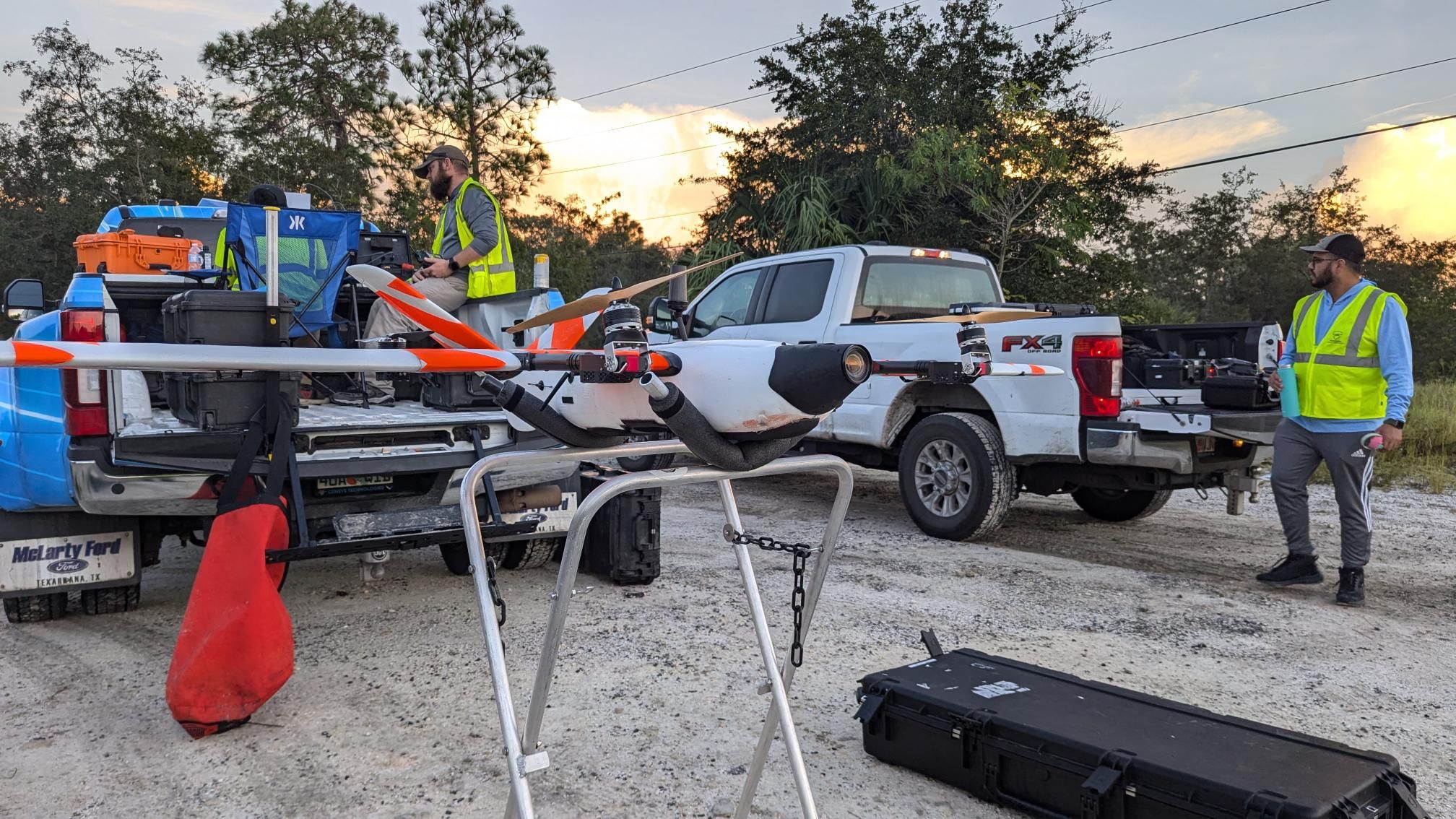
One of the most valuable aspects of the Sentaero 5 is its ability to operate Beyond Visual Line of Sight (BVLOS) and Over-The-Horizon (OTH), which allows the drone to cover significant distances without needing the operator to maintain direct visual contact. This capability makes it ideal for surveying vast areas affected by natural disasters, where rapid assessment is crucial.
What sets the Sentaero 5 apart is its cellular command and control (C2) link, onboard Detect-and-Avoid (DAA) technology, high-level autonomy enabling the aircraft to fly its mission without human input, and robust safety record. By utilizing a cellular network, similar to the one used by standard mobile phones, operators can control the drone with greater range and reliability. Onboard the drone are four SIM cards, which enable it to switch seamlessly between the strongest network connections. This feature is particularly beneficial in disaster zones, where communications infrastructure may be compromised. The cellular link allows for Sentaero operations spanning 10, 15, or even 20 miles out, far exceeding the typical 3-mile range of traditional radio systems. The farthest distance flown in the Helene operations was 28 miles.
Maximizing Efficiency Through Regulatory Support
Critical to the success of these operations were the Special Government Interest (SGI) waivers granted for each flight location. These waivers, provided by the Federal Aviation Administration (FAA), allowed the UAS crews to legally conduct BVLOS operations in areas where normal restrictions might otherwise apply.
Not only did these waivers facilitate the UAS missions, but the FAA also instituted Temporary Flight Restrictions (TFRs) in the affected areas, which provided a safe operational environment by restricting other air traffic. This coordination between regulatory agencies and UAS operators underscores the importance of government support in enabling effective disaster response using drones.
The SGI waivers played a pivotal role in ensuring that the data collection missions could be completed efficiently, safely, and without interference. These measures allowed the response teams to focus on gathering data quickly in areas.
Mission Results: Impact of UAS Data on Recovery Operations
The Sentaero crews were able to capture around 500 miles of roadways between Pine Island and Sanibel Island, including downtown Tampa, in just a few days, showcasing the efficiency of drone-based data collection in post-disaster scenarios. The data collected was instrumental in assessing road blockages, determining the extent of asset damage, and quantifying debris levels.
For instance, the high-resolution imagery captured by the Sentaero 5 provided detailed visuals of blocked roads, damaged infrastructure, and areas requiring immediate attention. This data was shared with response teams and used to optimize the dispatch of crews to clear roads and restore access to affected communities.
By prioritizing areas with the most significant damage or blockages, response teams were able to allocate their resources more effectively, reducing delays in the recovery process. This not only improved the speed of the recovery effort but also ensured that emergency services could reach critical locations faster.
Conclusion
The use of UAS in the response to Hurricane Helene highlights the transformative potential of drone technology in disaster scenarios. With platforms like the Sentaero 5, equipped with quality imaging technology and OTH BVLOS capabilities, teams can gather essential data over large areas in a fraction of the time it would take using traditional methods.
The operations carried out by the UAS crews provided critical information that informed response strategies and ensured that resources were deployed where they were most needed. As disaster response technologies continue to evolve, UAS will undoubtedly play an even larger role in future recovery efforts, proving themselves to be indispensable tools in safeguarding communities.
Read more:
- Censys Technologies Secures FAA Waiver for Drone Operations Over People and Moving Vehicles
- Breaking Barriers: Censys Technologies Soars to New Heights with 30-Mile BVLOS Flight Milestone
- Censys Adds LiDAR Options to Long-Range, BVLOS Fixed Wing
Like what you are reading? Subscribe to DroneLife!
 Adam Zirkelbach is the Marketing Director for Censys Technologies, a leading US-based provider of uncrewed aerial systems, specializing in the development and production of innovative BVLOS drones for various industries. With a focus on advanced technologies and user-centric design, Censys Technologies strives to deliver at the edge solutions that revolutionize the way businesses operate.

Miriam McNabb is the Editor-in-Chief of DRONELIFE and CEO of JobForDrones, a professional drone services marketplace, and a fascinated observer of the emerging drone industry and the regulatory environment for drones. Miriam has penned over 3,000 articles focused on the commercial drone space and is an international speaker and recognized figure in the industry. Miriam has a degree from the University of Chicago and over 20 years of experience in high tech sales and marketing for new technologies.
For drone industry consulting or writing, Email Miriam.
TWITTER:@spaldingbarker
Subscribe to DroneLife here.


Leave a Reply