
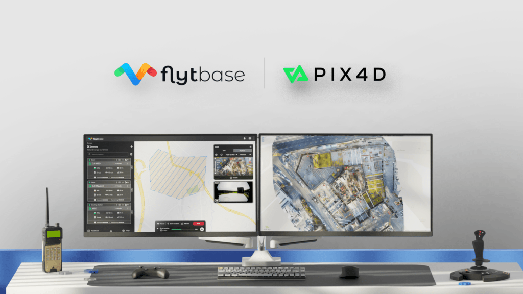

FlytBase, a drone autonomy software platform, has announced a strategic partnership with Pix4D, a leading photogrammetry platform for terrestrial and drone mapping. This collaboration aims to streamline drone data processing workflows by allowing FlytBase users to seamlessly upload their drone-captured data directly to the PIX4Dcloud online platform, thereby reducing manual interventions and simplifying project management.
As the adoption of automated drone-docked operations grows, the frequency and volume of data collection increase significantly. Operators are now capable of executing numerous daily missions and scheduling them in advance from remote command centers. However, the current process involves planning and executing docked flight operations on one platform, manually sorting through the captured data, and then uploading it to a separate application for processing into accurate maps and 3D models. This multi-step process can lead to inefficiencies, increased operational complexity, and operator errors.
The integration of FlytBase’s Pix4D Flink addresses these issues by enabling users to sync their drone-captured data directly from FlytBase to PIX4Dcloud. PIX4Dcloud processes high-resolution images using advanced photogrammetry algorithms, transforming them into accurate, georeferenced orthomosaics, 3D meshes, point clouds, and elevation models. This streamlined workflow is beneficial across various industries, including construction monitoring, mapping, and surveying.
FlytBase not only offers this one-click integration but also provides advanced automation functionalities necessary for docked drone operations. These capabilities include flight safety and fleet management, allowing users to conduct reliable and consistent drone data collection operations. Additionally, FlytBase integrates with beyond visual line-of-sight (BVLOS) hardware and software solutions, such as parachutes, detect-and-avoid systems, uncrewed traffic management, and weather monitoring systems, ensuring safe operations.
Adhering to ISO 27001, SOC 2 Type II, and GDPR standards, FlytBase ensures robust data protection through network firewalls and offers flexible deployment options to meet enterprise data privacy requirements.
“The integration of FlytBase and Pix4D addresses long-standing operational challenges in the drone industry by consolidating mission planning, data collection, processing, and analysis into a cohesive, end-to-end solution,” said Nitin Gupta, CEO & Founder of FlytBase.
Jeff Muller, Director of Platform at Pix4D, added, “Efficient drone monitoring of enterprise assets and construction projects has never been easier, thanks to the one-click integration of Pix4D’s photogrammetry technology and FlytBase’s drone autonomy platform. This seamless workflow will automatically deliver the data you need to make the right decisions to deliver the best outcomes.”
FlytBase and Pix4D will be hosting a webinar titled ‘Automating 3D Data Acquisition & Processing in Construction with Drone Docks’ on August 14 at 10:00 AM CT (15:00 GMT). Interested parties can register at https://flyt.link/docks-for-construction-mapping.
This partnership marks a significant step towards more efficient and integrated drone data processing workflows, ultimately enhancing operational efficiency and reducing complexity for users across various industries.
Read more:
- FlytBase, DroneDeploy Partner to Enable Autonomous Drone Operations and Reality Capture
- FlytBase and Iris Automation Integrate Ground-Based Detect and Avoid with FlytNow Software for Automated, Remote Drone Ops
- Flinks by FlytBase: Integration in Drone Operations


Miriam McNabb is the Editor-in-Chief of DRONELIFE and CEO of JobForDrones, a professional drone services marketplace, and a fascinated observer of the emerging drone industry and the regulatory environment for drones. Miriam has penned over 3,000 articles focused on the commercial drone space and is an international speaker and recognized figure in the industry. Miriam has a degree from the University of Chicago and over 20 years of experience in high tech sales and marketing for new technologies.
For drone industry consulting or writing, Email Miriam.
TWITTER:@spaldingbarker
Subscribe to DroneLife here.