by DRONELIFE Staff Writer Ian J. McNabb
Skydio, a California-based drone and UAV manufacturer focused on autonomy, recently announced a new strategic partnership with Trimble to create new integrated workflows designed to unite data capture, data visualization, and data analytics for the critical infrastructure industry when surveying, mapping, and inspecting. The collaboration, which is currently in the development stage, aims to produce centimeter-accurate results for surveying and mapping projects, utilizing a combination of Skydio’s UAV with a Trimble GNSS receiver and software package.
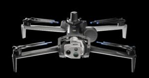
The new Skydio X10 integrated with Trimble’s Construction Cloud software package is designed to serve both public sector and corporate customers. The fully autonomous, API-based integration will allow for easy transfer of drone-captured video and metadata to Trimble Industry Cloud, turning it into actionable insights quicker and empowering faster decision making. In addition, the integration of Trimble’s GNSS receiver package and base station system with the RTK GPS-enabled X10 will allow for survey-grade accuracy on a variety of mapping projects. On top of RTK, customers will also be able to conduct PPK based corrections post flight.
“This collaboration brings together two leading companies and their innovative technologies to further revolutionize how we digitize and map our physical world,” said Gagan Kanwar, Skydio’s Head of Technology Partnerships. “By deepening product integration, organizations using Trimble and Skydio will benefit from survey-grade accuracy in mapping missions and go from data-to-insights that much faster.”
“Incorporating Skydio into our ecosystem augments our platform’s capabilities, offering our customers a fully integrated, end-to-end workflow from data acquisition to analytics,” said Aviad Almagor, Vice President of Technology Innovation at Trimble. “Our customers are seeking such automated workflows to handle the vast amount of data and maximize its value through improved production and quality control processes.”
This new partnership comes on the heels of the September unveiling of the new X10 and its improved sensor package and the October announcement of a collaboration with Teledyne Flir on their new Boson+ thermal module, showing the operational flexibility of the new autonomous UAV.
More information on the partnership between Skydio and Trimble is available here.
Ian McNabb is a staff writer based in Boston, MA. His interests include geopolitics, emerging technologies, environmental sustainability, and Boston College sports.

Miriam McNabb is the Editor-in-Chief of DRONELIFE and CEO of JobForDrones, a professional drone services marketplace, and a fascinated observer of the emerging drone industry and the regulatory environment for drones. Miriam has penned over 3,000 articles focused on the commercial drone space and is an international speaker and recognized figure in the industry. Miriam has a degree from the University of Chicago and over 20 years of experience in high tech sales and marketing for new technologies.
For drone industry consulting or writing, Email Miriam.
TWITTER:@spaldingbarker
Subscribe to DroneLife here.