
Guest post by Tero Heinonen, Sharper Shape Inc.—
 When drone technology first came on the scene, hobbyists and military personnel were the only ones paying attention. But now, the use of commercial drones is on the rise, and they are surprisingly impacting more industries. In the world of agriculture, drones are helping us grow more food by assisting farmers assess crop health. Search and rescue teams are using drones instead of spending thousands of dollars on helicopters to travel to remote areas to locate lost or missing people. Drone technology is poised to shake up the world, and people are starting to take notice.
According to Grand View Research Inc., every industrialized country is making investments in drones, and the global commercial drone market is expected to reach $2.07 billion by 2022. Some of the most highly anticipated drone technologies will improve the way we prevent and respond to emergencies, including disaster relief, protecting our power grid and even assisting news crews in dangerous situations.
Here are three ways drones are making our country safer.
They Aid Disaster Relief
It can take days, and sometimes weeks, to get the “all clear” for recovery teams to enter dangerous areas after disasters such as hurricanes, earthquakes or wildfires. It can also be difficult for recovery personnel to know which areas need immediate attention without having complete access.
From entering radiation-filled “hot zones” to scanning wildfires and searching for survivors across debris-filled landscapes, drones are now equipped with a wide range of technologies useful for disaster relief.
When the Nepal earthquake struck in May 2015, affecting more than 8 million people, rescue teams relied heavily on drones. GlobalMedic, a company that manages a fleet of drones for international disaster relief missions, was able to aerially map the area and stitch together the images into maps, providing snapshots of needs on the ground. This allowed the aid organization to identify flooded areas, obstructed roads, population movements and the damaged infrastructure. Equipped with thermal cameras, the drones were then able to identify people who were trapped or injured.
Furthermore, radiation and ultraviolet measurement tools and temperature sensors allow drones to test the environment and determine if it’s safe for relief crews to move in after a disaster. Drones can act as temporary telecommunication platforms to send Wi-Fi and cellphone coverage across areas with downed power lines and damaged cell towers, making it possible to communicate directly with those in affected areas.
In addition to assessing damage, drones can deliver tools needed to make infrastructure repairs, as well as survival supplies such as food and water, by using autonomous flight and coordination capabilities to go where vehicles can’t. Drones provide a safe, reliable way to help civilians immediately after disaster strikes.
They Protect the Power Grid
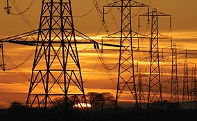
Our power grid is constantly under threat from trees falling on power lines. This interference is the No. 1 cause of power outages, and a source for some of the most devastating wildfires in history.
Vegetation management programs aimed at containing trees cost utilities and consumers billions of dollars each year. Currently, power line inspections are done by helicopters with LiDAR technology that provides 3D imaging, or by ground crews.
Long-distance drones carry lighter LiDAR technology as a more efficient way to scan tens of thousands of miles of power lines at a much cheaper cost.
New software can identify and store the data collected — including tree species and proximity to power lines — in a 3D map of the area. From there, the software analyzes the information to flag current and potential risks. Rather than inundate companies with too much data after each LiDAR test, this new software can automatically prioritize the risks found, so that utility companies can focus on urgent conditions now and budget for the rest.
This has already been proven in Europe — implementing long-distance drones to inspect and maintain thousands of miles of power line assets. Now, there is a new movement underway to deploy drones in a similar way in the United States.
With long-distance drone inspections, our power grid will be better protected from encroaching trees, which will decrease the number of power outages in our neighborhoods and prevent destructive wildfires.
They Keep News Crews Safe
Reporters oftentimes are expected to cover dangerous news stories, putting them directly in harm’s way as crimes and disasters continue to unfold. Since journalists cover shootings, car chases and storms, and an endless list of other life-threatening events, it’s no wonder that the United Nations cites journalism as one of the most dangerous professions in the world.
Drones with cameras have the ability to fly lower into smaller areas, so they can capture up-close and comprehensive footage of events, crime scenes, etc., while allowing reporters and camera crews to stay at a safe distance from the scene.
Instead of capturing a freeway aerial shot of a high-speed chase from a helicopter, employing a drone can do the same job more safely. Drones can use high-definition 3D imaging to take the shot, and use sense-and-avoid technology to prevent colliding with the vehicle and/or other objects potentially in its path. With the sense-and-avoid technology combined with visible light and infrared cameras, light detection and LiDAR, news coverage will look more like a movie than your typical 5 p.m. news report. Plus, drones can access these dangerous crime scenes without putting crews at risk.
Recently, the FAA gave cable network CNN the green light to test and fly drones for commercial newsgathering as part of its drone program, the UAS Focus Area Pathfinder initiative. The FAA is currently requiring CNN to fly its drones at heights under 400 feet and slower than 100 mph in populated areas.
Current drone technologies are maturing, and new technologies are advancing the market rapidly. With changing FAA regulations, drones are not only bringing a new era of efficiency in the U.S., they are helping save lives. In the near future, even more industries will have help from these modern-day superheroes.
About the Author, Tero Heinonen
CEO of Sharper Shape Inc., Tero Heinonen is an entrepreneurial and experienced start-up executive with a track record in international sales, tech and business management. Sharper Shape is the global market leader of automated drone-based asset inspection and is the first company to deploy commercial drones for utility asset inspection in Europe.
Tero has co-founded 5 technology companies, where he has served as CEO and/or Chairman.

Frank Schroth is editor in chief of DroneLife, the authoritative source for news and analysis on the drone industry: it’s people, products, trends, and events.
Email Frank
TWITTER:@fschroth






By far the safest way to inspect power lines. A helicopter went down not long ago doing an inspection. http://www.wbaltv.com/news/helicopter-crashes-near-bwi/39062572
The new technology we have for our UAV’s along with the data collection will make our power grid the most reliable it’s ever been.
Sounds like what we do! Go to http://www.rfguysuav.com check us out!