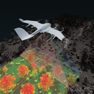
New Application Enables Efficient Infrastructure and Terrain Mapping Wingcopter has announced an expansion of its offerings to include long-range beyond visual line of sight (BVLOS) LiDAR surveying solutions. The Wingcopter 198, the company’s flagship drone, will be equipped with advanced laser scanning and camera systems to enable rapid, high-quality data … [Read more...] about Wingcopter Expands into Long-Range LiDAR Surveying
UAV surveying
GeoCue and Clogworks Technologies Announce Partnership to Expand LiDAR Drone Mapping Solutions
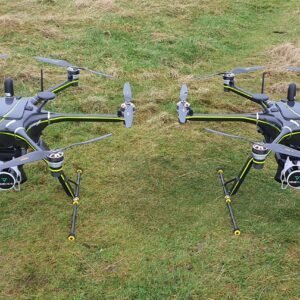
New Collaboration Enhances Aerial Surveying Capabilities with Integrated LiDAR and Software Solutions GeoCue has announced a new partnership with UK-based drone manufacturer Clogworks Technologies Limited. This collaboration integrates GeoCue’s TrueView LiDAR and LP360 software with Clogworks’ Dark Matter series of UAVs. The partnership aims to provide surveyors and mapping … [Read more...] about GeoCue and Clogworks Technologies Announce Partnership to Expand LiDAR Drone Mapping Solutions


