Trimble and DroneDeploy Collaborate to Enhance Drone Mapping Accuracy and Workflow Efficiency During GEO WEEK (Booth# 1001), Trimble (NASDAQ: TRMB) unveiled its latest collaboration with DroneDeploy, integrating the Trimble Applanix POSPac CloudⓇ post-processed kinematic (PPK) GNSS positioning service, featuring CenterPointⓇ RTX, with DroneDeploy's reality capture … [Read more...] about Centimeter Level Accuracy, Automated Workflow: Trimble and DroneDeploy Collaborate
Trimble
Trinity Pro Integrates Phase One P5 128 Megapixel Camera for a Survey Grade Drone Solution
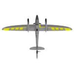
Quantum-Systems GmbH, a leading Munich-based drone manufacturer, has unveiled an innovative survey-grade UAV solution in collaboration with Phase One and Trimble. The Phase One P5 128-megapixel camera has been seamlessly integrated into Quantum Systems' flagship Trinity Pro mapping drone, marking a significant advancement in UAV-based mapping and surveying capabilities. The … [Read more...] about Trinity Pro Integrates Phase One P5 128 Megapixel Camera for a Survey Grade Drone Solution
DRONELIFE Exclusive: SenseFly’s Troy Hittle on Taking Drones Mainstream
At this week's InterGeo Conference, DRONELIFE had the opportunity to meet with Troy Hittle, senseFly's General Manager of the US and Canada, and talk about new partnerships, company focus, and what it will take for drones to move mainstream. Maintaining Focus - to Move Ahead senseFly's fixed wing drone is iconic in the industry. The eBee - and its descendants - were … [Read more...] about DRONELIFE Exclusive: SenseFly’s Troy Hittle on Taking Drones Mainstream
Delair Expands Drone Data Integration with Trimble Software
Commercial drone solution provider Delair this week announced the release of an new integration to its Trimble Business Center software. The integration enables geospatial professionals to drag and drop data from the Delair UX11 PPK drone system directly into Trimble Business Center projects. Users can combine high-quality flight data with other sensor data to create … [Read more...] about Delair Expands Drone Data Integration with Trimble Software
2018 Drone Industry Benchmark Survey: Who’s Buying Drones, Using Drone Software, and Why?
Skylogic Research, LLC, the leading research and advisory services firm for the commercial drone industry and owner of Drone Analyst®, just announced the launch of its third annual Drone Market Sector Research survey, which promises to be its most comprehensive study of drone market trends and usage to date. The online portion of this research seeks to get information about who … [Read more...] about 2018 Drone Industry Benchmark Survey: Who’s Buying Drones, Using Drone Software, and Why?


