
From Industry Buzz to Practical Workflow Gaussian splatting has quickly become one of the most talked-about developments in 3D reconstruction. Known for its ability to create highly realistic, smooth-rendered scenes, the technique has sparked a central question across the geospatial industry: can it move beyond visualization and support real-world mapping workflows? With the … [Read more...] about Gaussian Splatting Meets Photogrammetry: SimActive Integrates New Capability in Correlator3D
surveying technology
Blue Marble Geographics and Avenza Systems Combine to Create Unified Geospatial Platform

Merger connects office-based analysis with field operations for end-to-end spatial workflows Blue Marble Geographics and Avenza Systems, Inc. have announced a combined organization that will operate under the Blue Marble Geographics name. The move brings together complementary geospatial technologies designed to connect office-based spatial analysis with field data collection … [Read more...] about Blue Marble Geographics and Avenza Systems Combine to Create Unified Geospatial Platform
GeoCue Partners with JGC Geoinformation Systems to Expand LiDAR Mapping Solutions in Greece and Balkans
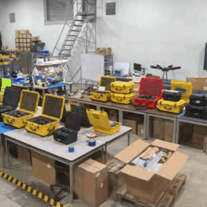
GeoCue, a leading provider of high-accuracy LiDAR mapping hardware and LP360 software, has announced a strategic distribution partnership with JGC Geoinformation System S.A. to bring TrueView LiDAR sensors and LP360 point cloud processing software to Greece, Cyprus, and Balkan countries. Drone LiDAR Mapping Technology for Regional Expansion The partnership positions JGC to … [Read more...] about GeoCue Partners with JGC Geoinformation Systems to Expand LiDAR Mapping Solutions in Greece and Balkans
GeoCue Expands LP360 with Advanced Visualization Tools
New 3D Model Mesh and Gaussian Splatting Add-Ons Unveiled at INTERGEO 2025 GeoCue has introduced two new visualization features for its LP360 software platform at INTERGEO 2025. The company announced the release of the 3D Model Mesh Add-On and the Gaussian Splatting Add-On, designed to improve realism and deliverable quality for users working with the TrueView GO handheld … [Read more...] about GeoCue Expands LP360 with Advanced Visualization Tools
Wingtra Unveils WingtraRAY: A New Drone to Transform Aerial Surveying

The new platform offers faster workflows, safer urban operations, and broad payload flexibility for surveyors worldwide. Wingtra's new drone, WingtraRAY, designed to push the limits of aerial surveying and mapping. The WingtraRAY is built specifically for surveyors and promises to remove many of the operational barriers they face today. One major highlight is its ability to … [Read more...] about Wingtra Unveils WingtraRAY: A New Drone to Transform Aerial Surveying


