
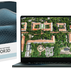
Advanced photogrammetry software supports rapid delivery of high-quality geospatial products SimActive Inc., a global developer of photogrammetry software, has announced that SurvTech Solutions is using its Correlator3D product to process large-scale image datasets from drones and large-format cameras. The software enables SurvTech to deliver digital surface models and … [Read more...] about SimActive’s Correlator3D Speeds Up Processing of Large Drone Datasets for SurvTech
SimActive
Does Better Positioning Really Improve Mapping Accuracy?

SimActive and Applanix Experts to Discuss the Role of High-Accuracy Positioning in Aerial Mapping Register for the Webinar:Thursday, June 12 | Two Live Sessions: 10 AM CET and 10 AM PSTRegister here SimActive will host a live interview on Thursday, June 12, bringing together two industry experts to explore the impact of advanced positioning systems on mapping accuracy. The … [Read more...] about Does Better Positioning Really Improve Mapping Accuracy?
SimActive Releases Correlator3D Version 10.4 with Enhanced 3D Model Controls
New Update Offers Greater Flexibility for Photogrammetry and LiDAR Workflows SimActive Inc., a leading developer of photogrammetry software, has released Version 10.4 of its Correlator3D platform. This new version gives users more control over 3D model creation, with advanced tools for both photogrammetry and LiDAR data. Full Control for Diverse Workflows Correlator3D … [Read more...] about SimActive Releases Correlator3D Version 10.4 with Enhanced 3D Model Controls
US Army Corps of Engineers Deploys SimActive’s Correlator3D for Coastal Corridor Mapping
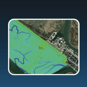
Correlator3D streamlines image processing for the Joint Airborne Lidar Bathymetry Technical Center of Expertise, enhancing topo-bathy lidar mapping efficiency. by DRONELIFE Staff Writer Ian J. McNabb SimActive Inc. recently announced that their Correlator3D product was deployed by the US Army Corps of Engineers for corridor mapping. The software is used to … [Read more...] about US Army Corps of Engineers Deploys SimActive’s Correlator3D for Coastal Corridor Mapping
Enhancing Drone Mapping with RTK and PPK: Insights from SimActive’s Eric Andelin

Drone mapping technology has advanced significantly in recent years, with Real-Time Kinematic (RTK) and Post-Processed Kinematic (PPK) positioning emerging as game-changing technologies. These methods enhance mapping accuracy and efficiency, reducing reliance on traditional Ground Control Points (GCPs). SimActive, a leading provider of photogrammetry software, offers powerful … [Read more...] about Enhancing Drone Mapping with RTK and PPK: Insights from SimActive’s Eric Andelin


