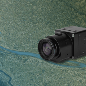
Correlator3D enables sub-centimeter processing for fixed-wing survey missions SimActive has announced full support for the Phase One iXM-FS130 sensor in its Correlator3D platform. The integration allows mapping professionals to process sub-centimeter aerial imagery efficiently while maintaining speed and accuracy. The company made the announcement on February 19, 2026. … [Read more...] about SimActive Integrates Phase One iXM-FS130 for High-Resolution Aerial Mapping
Phase One
Phase One Unveils iXM-FS130 Camera for Sub-Centimeter Aerial Mapping
Phase One has announced the iXM-FS130, a next-generation aerial mapping camera designed to capture sub-centimeter ground sample distance imagery from fixed-wing aircraft at speeds exceeding 120 knots. The camera introduces Phase One's patented Fusion Shutter technology to the commercial aerial mapping market. This enables operators to maintain image quality while increasing … [Read more...] about Phase One Unveils iXM-FS130 Camera for Sub-Centimeter Aerial Mapping
Orkid Unveils All-in-One Drone Combining LiDAR, Photogrammetry, GNSS, and Starlink

Orkid has announced a new variant of its ORKID 260 vertical take-off and landing (VTOL) drone, bringing together four of the most advanced aerial data capture technologies into one integrated, NDAA-compliant system. The ORKID 260VTOL integrated drone combines LiDAR, photogrammetry, GNSS, and Starlink satellite connectivity onboard, allowing all systems to operate … [Read more...] about Orkid Unveils All-in-One Drone Combining LiDAR, Photogrammetry, GNSS, and Starlink
Blue Marble Geographics Unveils Global Mapper® v26.2 at Intergeo 2025

New update delivers user-driven interface improvements, expanded visualization tools, and enhanced file format support. Blue Marble Geographics has announced the release of Global Mapper® v26.2, the latest version of its all-in-one GIS software. The update was introduced this week at Intergeo 2025, the international mapping conference taking place in Frankfurt, Germany this … [Read more...] about Blue Marble Geographics Unveils Global Mapper® v26.2 at Intergeo 2025
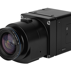
From the Floor of Intergeo 2025: Phase One Unveils Advanced Drone Camera Systems

Phase One demonstrated comprehensive aerial imaging technologies at Intergeo 2025 in Frankfurt, showcasing new drone camera integration solutions designed for professional geospatial applications. The company announced hardware and software developments targeting surveying, inspection, and mapping operations across multiple UAV platforms. iXM-RS250 Aerial Camera Technical … [Read more...] about From the Floor of Intergeo 2025: Phase One Unveils Advanced Drone Camera Systems


