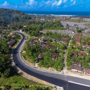
As governments invest in infrastructure to unlock tourism and regional growth, the challenge is no longer just building roads. It is building roads that can endure terrain, climate, and time. A recent case study from Blue Marble Geographics demonstrates how drone-based photogrammetry and watershed modeling are helping engineers design a more resilient transportation corridor … [Read more...] about Designing Resilient Roads on Java’s Southern Coast: A Blue Marble Geographics Case Study
infrastructure mapping
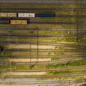
Blue Marble Shows How AI and LiDAR Deliver ROI for Rail Operators
A New Moment for BVLOS Operations Drone operators in the U.S. now have more access to Beyond Visual Line of Sight (BVLOS) waivers than ever before. These waivers allow a single operator to fly longer routes without placing observers along the entire path. The FAA’s recent publication of the BVLOS Notice of Proposed Rulemaking (NPRM) also marks the first step toward routine … [Read more...] about Blue Marble Shows How AI and LiDAR Deliver ROI for Rail Operators
SimActive Software Supports Highway Ramp Expansion Through Integrated Lidar and Photogrammetry

SimActive Inc., a global developer of photogrammetry software, announced that its Correlator3D platform is being used by Settimio Consulting Services to support the engineering design of a major highway ramp expansion. The project leverages the integration of photogrammetry and lidar data to produce precise ground measurements essential for accurate infrastructure … [Read more...] about SimActive Software Supports Highway Ramp Expansion Through Integrated Lidar and Photogrammetry


