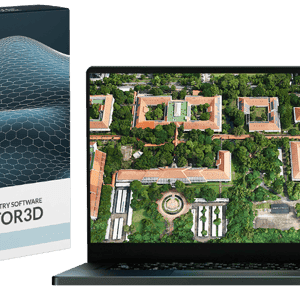
New Update Offers Greater Flexibility for Photogrammetry and LiDAR Workflows SimActive Inc., a leading developer of photogrammetry software, has released Version 10.4 of its Correlator3D platform. This new version gives users more control over 3D model creation, with advanced tools for both photogrammetry and LiDAR data. Full Control for Diverse Workflows Correlator3D … [Read more...] about SimActive Releases Correlator3D Version 10.4 with Enhanced 3D Model Controls
drone data processing
Censys Technologies Introduces Sentaero 6: Advancing Over-the-Horizon BVLOS Operations
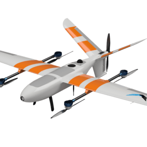
Censys Technologies has unveiled the Sentaero 6, a new uncrewed aerial system (UAS) designed to push Over-the-Horizon Beyond Visual Line of Sight (OTH BVLOS) operations forward. Built with customer input and regulatory insight, this latest model aims to provide a more capable and efficient solution for asset intelligence. Advancing BVLOS Capabilities Since 2021, Censys … [Read more...] about Censys Technologies Introduces Sentaero 6: Advancing Over-the-Horizon BVLOS Operations
Mastering Drone Mapping: Expert Tips for Success from SimActive’s Eric Andelin

SimActive and Correlator3D™: A Closer Look Drone mapping has transformed industries by making geospatial data more accessible. However, achieving high-quality results requires both the right tools and the right approach. DRONELIFE.com interviewed Eric Andelin, Senior Workflow Specialist at SimActive, to uncover actionable tips for drone operators. SimActive, a leader in … [Read more...] about Mastering Drone Mapping: Expert Tips for Success from SimActive’s Eric Andelin
FlytBase and Pix4D Partner to Streamline Drone Data Processing Workflows
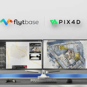
Integration Simplifies Project Management for Automated Drone Operations FlytBase, a drone autonomy software platform, has announced a strategic partnership with Pix4D, a leading photogrammetry platform for terrestrial and drone mapping. This collaboration aims to streamline drone data processing workflows by allowing FlytBase users to seamlessly upload their drone-captured … [Read more...] about FlytBase and Pix4D Partner to Streamline Drone Data Processing Workflows
Flinks by FlytBase: Integration in Drone Operations

Bridging the Gap in Enterprise Drone Applications for Enhanced Efficiency and Safety FlytBase, the leading enterprise drone autonomy platform, has unveiled Flinks, a new feature designed to streamline the integration of the FlytBase platform with a multitude of third-party applications and devices. Dubbed Flinks, short for FlytBase Links, this innovative offering functions … [Read more...] about Flinks by FlytBase: Integration in Drone Operations


