Streamline Data Collection and Processing with Global Mapper Mobile By Amanda Lind The following article is sponsored content. Streamline your field-to-office workflow by taking advantage of Global Mapper Mobile’s ability to collect high-accuracy vector data in the field. Continue reading below, or listen: DroneLife · Blue - Marble - Global - Mapper - Mobile Available on … [Read more...] about Global Mapper Mobile: Streamlining Data Collection and Processing
Blue Marble Graphics
Drone Mapping: Global Mapper Mobile New Features Mean Higher Accuracy Data Collection
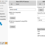
Introducing Global Mapper Mobile’s New GNSS Device Support via TCP/IP Communication Global Mapper Pro is a powerful geospatial data analysis program that contains tools for everything from raster image processing to photogrammetric point cloud creation with the Pixels to Points tool. Designed to work alongside Global Mapper Pro, the free iOS and Android Global Mapper Mobile … [Read more...] about Drone Mapping: Global Mapper Mobile New Features Mean Higher Accuracy Data Collection


