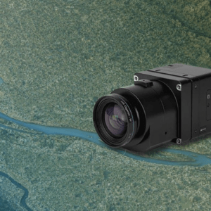
Correlator3D enables sub-centimeter processing for fixed-wing survey missions SimActive has announced full support for the Phase One iXM-FS130 sensor in its Correlator3D platform. The integration allows mapping professionals to process sub-centimeter aerial imagery efficiently while maintaining speed and accuracy. The company made the announcement on February 19, 2026. … [Read more...] about SimActive Integrates Phase One iXM-FS130 for High-Resolution Aerial Mapping
aerial mapping
Phase One Unveils iXM-FS130 Camera for Sub-Centimeter Aerial Mapping
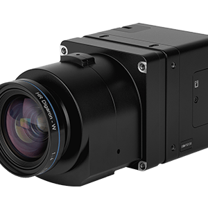
Phase One has announced the iXM-FS130, a next-generation aerial mapping camera designed to capture sub-centimeter ground sample distance imagery from fixed-wing aircraft at speeds exceeding 120 knots. The camera introduces Phase One's patented Fusion Shutter technology to the commercial aerial mapping market. This enables operators to maintain image quality while increasing … [Read more...] about Phase One Unveils iXM-FS130 Camera for Sub-Centimeter Aerial Mapping
SimActive Expands Mapping Capacity With Distributed Processing in Correlator3D

New capability supports faster turnaround for large and time-sensitive photogrammetry projects SimActive has announced new distributed processing capabilities in its Correlator3D™ photogrammetry software. The update allows mapping workflows to run across multiple computers or virtual machines instead of relying on a single system. The goal is to help organizations process … [Read more...] about SimActive Expands Mapping Capacity With Distributed Processing in Correlator3D
GeoCue Partners with JGC Geoinformation Systems to Expand LiDAR Mapping Solutions in Greece and Balkans
GeoCue, a leading provider of high-accuracy LiDAR mapping hardware and LP360 software, has announced a strategic distribution partnership with JGC Geoinformation System S.A. to bring TrueView LiDAR sensors and LP360 point cloud processing software to Greece, Cyprus, and Balkan countries. Drone LiDAR Mapping Technology for Regional Expansion The partnership positions JGC to … [Read more...] about GeoCue Partners with JGC Geoinformation Systems to Expand LiDAR Mapping Solutions in Greece and Balkans
Managing Large Photogrammetry Projects Simultaneously: Can It Be Done?

How scalable workflows, automation, and distributed processing make managing large photogrammetry projects possible. DRONELIFE spoke with Philippe Simard, co-founder and CEO of SimActive, the Canadian company behind the Correlator3D photogrammetry suite, to explore one of the most pressing challenges in the aerial mapping industry: how to efficiently manage and process … [Read more...] about Managing Large Photogrammetry Projects Simultaneously: Can It Be Done?


