
As defense budgets rise and geopolitical tensions reshape operational priorities, militaries are investing heavily in technologies that can turn raw data into timely, actionable intelligence. For photogrammetry company SimActive, that mission has been central since its founding. In a recent interview with DRONELIFE, CEO Dr. Philippe Simard discussed how the … [Read more...] about Rapid Mapping for a 24/7 Defense Environment: SimActive on Speed, Security, and Scalable Intelligence
aerial imagery processing
US Army Corps of Engineers Deploys SimActive’s Correlator3D for Coastal Corridor Mapping
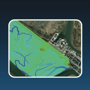
Correlator3D streamlines image processing for the Joint Airborne Lidar Bathymetry Technical Center of Expertise, enhancing topo-bathy lidar mapping efficiency. by DRONELIFE Staff Writer Ian J. McNabb SimActive Inc. recently announced that their Correlator3D product was deployed by the US Army Corps of Engineers for corridor mapping. The software is used to … [Read more...] about US Army Corps of Engineers Deploys SimActive’s Correlator3D for Coastal Corridor Mapping


