
Webinar to Offer Strategies for Streamlining Large-Scale Geospatial Data Processing SimActive Inc., a leading developer of photogrammetry software, will host a live webinar focused on managing multiple large-scale mapping projects at once. The session will take place online and is open to professionals interested in learning how to streamline complex workflows in … [Read more...] about Managing Multiple Photogrammetry Projects: SimActive Hosts Expert Webinar
aerial imagery
John Deere Acquires Sentera to Expand Aerial Scouting Capabilities

Acquisition Aims to Boost Data-Driven Decision Making for Farmers Through Drone Imagery and Integrated Platforms John Deere has announced the acquisition of Sentera, a Minnesota-based provider of remote imagery solutions for agriculture. The move is set to enhance John Deere’s precision agriculture tools by integrating high-resolution drone imagery into its existing digital … [Read more...] about John Deere Acquires Sentera to Expand Aerial Scouting Capabilities
EagleView’s High-Tech Response to Natural Disasters: Capturing Devastation from Above

EagleView produces high-resolution images in the wake of disasters By DRONELIFE Features Editor Jim Magill Soon after two powerful and devastating hurricanes, Helene and Milton, struck Florida within weeks of each other last fall, data analytics company EagleView Technologies was on the scene, capturing high-resolution aerial images of the destruction to aid recovery efforts … [Read more...] about EagleView’s High-Tech Response to Natural Disasters: Capturing Devastation from Above
Affordable Mapping Revolution: AerologixMaps Empowers Drone Businesses
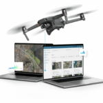
AerologixMaps: Affordable, Scalable Mapping Software In the rapidly evolving world of drone technology, a new mapping solution is filling a gap in the market for small and medium size drone businesses. AerologixMaps, developed by Australian drone industry pioneer Aerologix, is transforming drone footage into high-resolution maps with unprecedented affordability. With … [Read more...] about Affordable Mapping Revolution: AerologixMaps Empowers Drone Businesses
SimActive Enhances Cloud Productivity with Correlator3D Upgrade

Latest SimActive Upgrade of Correlator3D™ Boosts Cloud Capabilities for Enhanced Productivity SimActive Inc., a global leader in photogrammetry software development, has announced significant enhancements to its Correlator3D™ software, aimed at improving productivity in cloud environments. The upgrade allows clients to effortlessly scale their processing in alignment with … [Read more...] about SimActive Enhances Cloud Productivity with Correlator3D Upgrade


