
But development is vibrant, and you’ll see it work first in prosumer drones QuickTake THE FACTS: “Sense and avoid” for drones is a popular topic in the press right now, but the phrase can mean different things in different contexts and for different people. To clarify, there is a difference between solving the problem of “sense” and solving the problem of “avoid.” Also, there … [Read more...] about Sense and Avoid for Drones is No Easy Feat
Colin Snow
Can PrecisionHawk Tame Drone Traffic in the Sky?

PrecisionHawk’s LATAS delivers an innovative air traffic control system for drones, but it’s one of several that depends on the not-so-imminent success of all aircraft using ADS-B. QuickTake THE FACTS: This past week, the FAA granted PrecisionHawk a waiver from Part 107.31’s visual line of sight (VLOS) limitations, which gives them the ability to continue their research and … [Read more...] about Can PrecisionHawk Tame Drone Traffic in the Sky?
Will the U.S.’s New Drone Pilot Certification Accelerate Commercial Growth?

FAA testing and certification for small UAS remote pilot certificates begins in earnest this month, but does that mean the commercial drone industry will see rapid growth? QuickTake THE FACTS: Beginning August 29, 2016, the new small UAS Rule for commercial drone operations in the U.S. takes effect. One very important change is that operators will now have to obtain a remote … [Read more...] about Will the U.S.’s New Drone Pilot Certification Accelerate Commercial Growth?
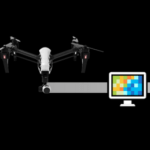
DJI’s Foray into the Enterprise Drone Market

Will its reliance on channel partnerships address the real needs of commercial operators? QuickTake THE FACTS: Without the usual fanfare associated with a new product release, consumer drone manufacturer DJI opened up a website (http://enterprise.dji.com) in July 2016 that is dedicated to commercial / enterprise use of their drones. The website lists five industrial uses: … [Read more...] about DJI’s Foray into the Enterprise Drone Market
Is Esri’s Drone2Map a Game Changer?
Features should appeal to Esri users, but will they appeal to non-Esri users? QuickTake THE FACTS: In February 2016, Esri released an application called Drone2Map for ArcGIS. Drone2Map (D2M) takes raw image data from drones and creates digital surface models, orthomosaics, 3D-point clouds and 3D PDFs that can be shared. Data processed by Drone2Map can also be rendered in … [Read more...] about Is Esri’s Drone2Map a Game Changer?


