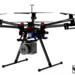
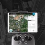
CyPhy Works, Inc. and Pilot Thomas Logistics are providing UAV services to customers in the oil and gas industry using CyPhy's Persistent Aerial Reconnaissance and Communications (PARC) system, a persistent drone with recorded flights of 200+ hours. The collaboration is yet another is a string of partnerships that are forming between established companies in the construction … [Read more...] about CyPhy Works and Pilot Thomas Logistics Partner to Deliver UAV Services to the Oil and Gas Industry.
Industries
Report: LiDAR Drone Market Will Soar into 2020
LiDAR sensors and drones go together like PB&J and an industry report paints a rosy picture for both industries. “Global market intelligence company” Transparency Market Research released a study last week predicting an increase in the Light Detection and Ranging market as it relates to drone combos. Following the explosion in drone adoption across precision … [Read more...] about Report: LiDAR Drone Market Will Soar into 2020
DJI Launches Products for Commercial Pilots at CES 2017
Forget Christmas. For tech fans and keen watchers of the drone industry, the Consumer Electronics Show represents the real festive season. CES 2017 is here, and we're expecting plenty of product and partnership announcements from both the biggest and smallest names in the industry. Today we've had news from DJI. To continue its domination of the drone market, it's launching … [Read more...] about DJI Launches Products for Commercial Pilots at CES 2017
DJI Releases Sleek New Kit for Drone Developers
DJI, the world’s largest drone manufacturer, unveiled a major upgrade in its software development toolkit last week during the Chinese company’s AirWorks conference in San Francisco. In a press release, company officials said its new software enhancements will allow developers to build on each other’s work via DJI’s Mobile and Onboard Software Development Kit … [Read more...] about DJI Releases Sleek New Kit for Drone Developers
Keep Your Construction Project on Track with Drone Mapping
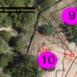
Guest post by DroneDeploy — Project Managers Use Drone Maps to Communicate with Stakeholders, Monitor Progress and More More and more, project managers are finding drone mapping to be an indispensable tool during all phases of construction. Easy-to-use software allows them to create high-resolution orthomosaic, elevation and 3D maps in a matter of hours. Combined with … [Read more...] about Keep Your Construction Project on Track with Drone Mapping


