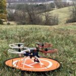
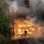
Researchers with The Ohio State University are using autonomous drones to help prevent and mitigate wildfires. As witnessed by the ongoing blazes across the U.S., wildfires are difficult to predict and fight. Flames can travel up to 14 mph in dry grass and spread in unexpected directions. An OSU team led by mechanical and aerospace engineering professor Mrinal Kumar … [Read more...] about OSU Researchers Launch Autonomous Drones to Study Wildfires
Fire
Fighting Wildfires with Advanced Technology Aerial Firefighting
Advancing Technology Aerial Firefighting Through Massive Multimodal Mobility By: Dawn Zoldi The United States (U.S.) is on fire… literally. According to the National Interagency Fire Center, this calendar year the nation has experienced 39,955 wildfires, two thousand plus more than the ten-year average (37,675). Thus far, 104 large fires have ravaged 2.4 million … [Read more...] about Fighting Wildfires with Advanced Technology Aerial Firefighting
DJI Still Dominates Public Safety Sector, Survey Finds
A newly released market survey by AIRT and DRONERESPONDERS reveals that DJI continues to dominate the public safety sector, holding more than 90% of the market share: while Autel Robotics holds the number 2 position. The research was performed by Airborne International Response Team (AIRT), the leading 501(c)3 non-profit organization supporting the use of unmanned systems for … [Read more...] about DJI Still Dominates Public Safety Sector, Survey Finds
Videogrammetry for Thermal Mapping: Game Changing Technology for First Responders
A new partnership between Autel Robotics and SkyeBrowse introduces videogrammetry for thermal mapping: helping first responders perform night-time accident reconstruction, pre-plan for wildfires, and perform swat scouts. The following is a guest post by Gulraiz Khalid, Marketing Director at SkyeBrowse. DRONELIFE neither accepts nor makes payment for guest posts. In early … [Read more...] about Videogrammetry for Thermal Mapping: Game Changing Technology for First Responders
Spanish Researchers Deploy Drones to Improve Wildfire Prediction
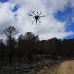
As summer heats up, experts are expecting another scorching forest-fire season—especially with the added uncertainty fanned by climate change. However, Toledo University is finding new ways to predict forest fires using drone technology. Partnering with European drone LiDAR solution provider Routescene, the university assessed a forest-fire site in the Spanish province of … [Read more...] about Spanish Researchers Deploy Drones to Improve Wildfire Prediction

