
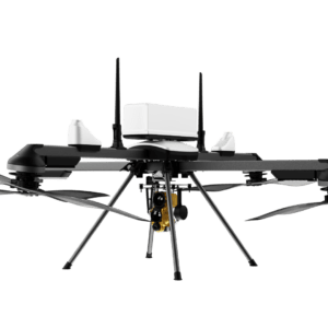
Successful Fixed-Wing VTOL Flight Covers 320 Miles for Shell Pipeline Corporation Event 38 Unmanned Systems and Phoenix Air Unmanned (PAU) have completed a beyond visual line of sight (BVLOS) pipeline inspection demo using the E455 fixed-wing vertical takeoff and landing (VTOL) drone. The demonstration covered 320 miles in just under 7.6 flight hours, validating the potential … [Read more...] about Event 38 and Phoenix Air Unmanned Complete BVLOS Pipeline Inspection Demo
Featured - Surveying
Mastering Drone Mapping: Expert Tips for Success from SimActive’s Eric Andelin

SimActive and Correlator3D™: A Closer Look Drone mapping has transformed industries by making geospatial data more accessible. However, achieving high-quality results requires both the right tools and the right approach. DRONELIFE.com interviewed Eric Andelin, Senior Workflow Specialist at SimActive, to uncover actionable tips for drone operators. SimActive, a leader in … [Read more...] about Mastering Drone Mapping: Expert Tips for Success from SimActive’s Eric Andelin
India Launches Major Initiative to Share Geospatial Information Across Sectors
Operation DRONAGIRI leverages drones and geospatial technology to improve decision-making and foster innovation. India has launched Operation DRONAGIRI, a groundbreaking pilot project under the National Geospatial Policy 2022. The initiative aims to enhance collaboration and innovation across industries by integrating geospatial data and technology. Sectors like agriculture, … [Read more...] about India Launches Major Initiative to Share Geospatial Information Across Sectors
Wingtra Unveils MAP61: The Game-Changing Mapping Payload Redefining Survey Efficiency
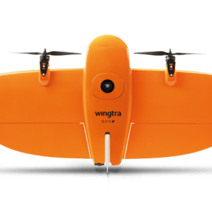
New Payload Slashes Time and Boosts Efficiency for Complex Survey Projects by DRONELIFE Staff Writer Ian J. McNabb At InterGeo this week, Switzerland-based drone manufacturer Wingtra recently announced their new MAP61 mapping payload, which they describe as “the most efficient mapping sensor on the market”. Able to capture up to 1,140 acres in a single flight, the MAP61 is … [Read more...] about Wingtra Unveils MAP61: The Game-Changing Mapping Payload Redefining Survey Efficiency
North Carolina Drone Photographer Seeks Supreme Court Support for First Amendment Rights

Michael Jones asks the court to uphold his right to provide aerial information to clients. Yesterday, the Institute for Justice (IJ) filed a petition with the United States Supreme Court on behalf of Michael Jones, a drone photographer in North Carolina. The case brings forward an important question: does providing data and information through aerial photographs qualify as … [Read more...] about North Carolina Drone Photographer Seeks Supreme Court Support for First Amendment Rights


