Flyability Unveils the Elios 3 LiDAR Drone for Dark, Dirty and Dangerous Indoor Spaces by DRONELIFE Staff Writer Ian M. Crosby Today, Flyability launched its Elios 3, the first ever collision-tolerant drone equipped with a LiDAR sensor for indoor 3D mapping. Continue reading or listen below: DroneLife · Flyability - Elios - 3-LiDAR - Indoor - Drone - For - The - … [Read more...] about For the Dark, Dirty and Dangerous, Flyability Elios 3 LiDAR Drone: Check Out this Fly Through a Decommissioned Nuclear Plant
Featured - Mining
Simactive Works to Increase Value in Mining and Surveying Drone Market
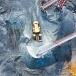
Canadian mapping software company SimActive has added additional capacity to be able to automatically assess multiple volumes of material (aggregates and other material) for projects and to report based upon the findings. If the same area is being flown, users can then compare the volumes and access differences over time. This allows companies to be able to better plan … [Read more...] about Simactive Works to Increase Value in Mining and Surveying Drone Market
Fully Automated Drone Solutions and 5G Networks are a Game Changing Combination
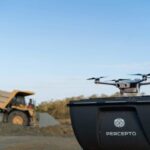
A DRONELIFE Exlusive interview with Dor Abuhasira, Co-Founder and CEO of Percepto. Of all of the buzz words used in the drone industry in 2019, "automation" was one of the biggest. Along with AI , drone companies touted automation in every aspect of drone use. There are not many drone companies, however, for whom autonomous flight truly means flight without the presence of … [Read more...] about Fully Automated Drone Solutions and 5G Networks are a Game Changing Combination
Mining for Gold on the Ivory Coast with Drones: SimActive’s Digital Terrain Models
SimActive Software Used for Gold Mine Mapping Montreal, Canada, September 3rd, 2019 – SimActive Inc., a world-leading developer of photogrammetry software, announces that Correlator3D™ is being used for gold mining projects in Ivory Coast by Newcrest Mining Limited. SimActive software is employed to produce dense digital terrain models (DTMs) using small format digital … [Read more...] about Mining for Gold on the Ivory Coast with Drones: SimActive’s Digital Terrain Models
SETI Institute Drone Maps Iceland Lava Cave in Preparation for Mars and Moon Exploration
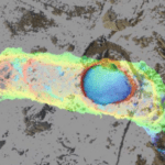
The SETI Institute is probably best known for its work scanning the stars for signs of extraterrestrial communications. But the organization's remit is broader than that. Its many research teams work towards a noble goal: to explore, understand, and explain the origin and nature of life in the universe. Exploring other planets isn't a task to be taken lightly. Equipment and … [Read more...] about SETI Institute Drone Maps Iceland Lava Cave in Preparation for Mars and Moon Exploration

