Red Cat and Doodle Labs Triumph in Electronic Warfare Tests in Ukraine: collaboration demonstrates enhanced anti-jamming capabilities for drones amid ongoing military challenges. Red Cat Holdings, Inc. (Nasdaq: RCAT), a prominent player in drone technology, has announced a successful outcome in electronic warfare testing in Ukraine alongside Doodle Labs. This initiative is … [Read more...] about Resisting Enemy Drone Jamming Attempts: Red Cat, Doodle Labs Electronic Warfare Tests in Ukraine
Products
US-Based Anzu Robotics Launches Raptor Series Drones with Emphasis on Security and Performance
New platforms combine advanced hardware with US-developed software to meet diverse industrial needs. Anzu Robotics, LLC has announced its new Raptor and Raptor T drone platforms, marking the company's entry into the competitive drone market. These platforms are distinguished by their combination of advanced hardware and secure, sophisticated software developed in the United … [Read more...] about US-Based Anzu Robotics Launches Raptor Series Drones with Emphasis on Security and Performance
Skyfish Unveils New Portable American-Made, Engineering Grade Drone
Osprey Drone to Enhance Infrastructure Inspection and ISR Capabilitie Skyfish, a Montana-based American drone manufacturer, has announced the release of the Osprey, a new lightweight drone designed for professional use in infrastructure inspections and intelligence, surveillance, and reconnaissance (ISR). The drone will be introduced at the upcoming … [Read more...] about Skyfish Unveils New Portable American-Made, Engineering Grade Drone
Flyability to Introduce New Drone Technology at Denver Event
Flyability, a leader in drone solutions for confined spaces, has announced an upcoming event in Denver, Colorado, to unveil its new ultrasonic thickness payload in North America. Scheduled for May 1st and 2nd, the event will showcase the latest addition to the Elios 3 drone series. The Denver launch event is set to offer a hands-on experience with the Ultrasonic Thickness … [Read more...] about Flyability to Introduce New Drone Technology at Denver Event
Innovative Wind Prediction System “WindAware” Could Enhance UAS Safety and Efficiency in Urban Airspace
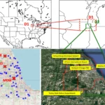
Enhancing Urban Air Mobility: UND's WindAware System Transforms UAS Operations with Advanced Wind Prediction Technology Researchers at the University of North Dakota (UND), a distinguished institution in the field of Unmanned Aircraft Systems (UASs), have unveiled a groundbreaking intelligent prediction system named “WindAware”. This system represents a significant step … [Read more...] about Innovative Wind Prediction System “WindAware” Could Enhance UAS Safety and Efficiency in Urban Airspace

