• Skip to main content
  • Skip to secondary menu
  • Skip to primary sidebar
  • Skip to secondary sidebar
  • Skip to footer
  • DroneRacingLife
  • DroneFlyers
  • Newsletter
DroneLife

DRONELIFE

Stay up to date on all the latest Drone News

  • News
  • Products
  • Industries
    • Agriculture
    • Construction
    • Delivery
    • Dual Use
    • Inspection
    • Public Safety
    • Surveying
  • Enthusiasts
  • Regulations
  • Business
  • Video
  • Podcasts

Optelos Launches New Software Tool for Easily Managing, Analyzing and Sharing Orthomosaic Data

September 4, 2017 by Frank Schroth 7 Comments


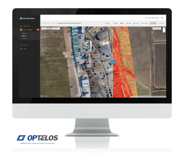
Optelos, an Austin based drone data analytics firm, has announced the launch of FlyView OrthoCompare, a software tool that enables drone service providers to manage the size and variety of image files collected and delivering meaningful orthomosaics to their clients.

David Tran, CEO of Optelos, said “Customers have told us one of their biggest challenges was to easily deliver large Orthomosaic files to all their clients and providing the ability to view and interrogate the data.   Moreover, many users wanted the ability to compare multiple Orthomosaics over time to see changes and gain other insights.  These challenges diminished the value of the data and overall end-user experience.”

Drone Service Providers capture hundreds and thousands of images and utilize processing software like Pix4D & Drone Deploy to generate highly detailed geo-referenced Orthomosaics imagery.  However, there are challenges to delivering these Orthomosaics to end-user and clients.  The datasets range in size from hundreds megabytes to several gigabytes in size and clients need specialized software tools that can be use and time consuming in order to view their orthomosaic datasets.

FlyView OrthoCompare resolves issues drone operators have with managing, analyzing or sharing their data.

The tool is designed to simplify the process for users by enabling drone operators to overlay and compare high-resolution Orthomosaics with a simple three-step process:

  1. Upload GeoTIFF: Operators export their orthomosaics in GeoTIFF format to the Optelos Drone Work Advisor platform.
  2. Process: Optelos processes the GeoTIFF real-time and operators can access the results in just a matter of minutes.
  3. Visualize: Operators can view orthomosaics along with geo-located images, overlay multiple orthomosaics via an opacity slider, and compare orthomosaics side-by-side to quickly gather insights

This addresses many of the challenges and bottlenecks operators face.

The goal of Optelos OrthoCompare is for users and clients to quickly and easily gather and understand, and share the insights their data contains.

For more information about this product or the other offerings from Optelos visit http://www.optelos.com or contact Optelos directly at info@optelos.com.
Frank Schroth
Frank Schroth

Frank Schroth is editor in chief of DroneLife, the authoritative source for news and analysis on the drone industry: it’s people, products, trends, and events.
Email Frank
TWITTER:@fschroth

Filed Under: Imaging, Products Tagged With: Optelos, orthomosaics

Reader Interactions

Trackbacks

  1. Optelos Launches New Software Tool for Easily Managing, Analyzing and Sharing Orthomosaic Data – CHB Blog says:
    September 4, 2017 at 7:44 pm

    […] Read the full article from the Source… […]

    Reply
  2. Optelos Launches New Software Tool for Easily Managing, Analyzing and Sharing Orthomosaic Data - Tec Ofertas UK says:
    September 4, 2017 at 9:46 am

    […] post Optelos Launches New Software Tool for Easily Managing, Analyzing and Sharing Orthomosaic Data appeared first on […]

    Reply
  3. Optelos Launches New Software Tool for Easily Managing, Analyzing and Sharing Orthomosaic Data - Tec Ofertas says:
    September 4, 2017 at 9:05 am

    […] post Optelos Launches New Software Tool for Easily Managing, Analyzing and Sharing Orthomosaic Data appeared first on […]

    Reply
  4. Optelos Launches New Software Tool for Easily Managing, Analyzing and Sharing Orthomosaic Data - Drones Deal says:
    September 4, 2017 at 8:17 am

    […] post Optelos Launches New Software Tool for Easily Managing, Analyzing and Sharing Orthomosaic Data appeared first on […]

    Reply
  5. Optelos Launches New Software Tool for Easily Managing, Analyzing and Sharing Orthomosaic Data – TheDrones.Link says:
    September 4, 2017 at 8:08 am

    […] post Optelos Launches New Software Tool for Easily Managing, Analyzing and Sharing Orthomosaic Data appeared first on […]

    Reply
  6. Optelos Launches New Software Tool for Easily Managing, Analyzing and Sharing Orthomosaic Data – Dronegram says:
    September 4, 2017 at 7:44 am

    […] post Optelos Launches New Software Tool for Easily Managing, Analyzing and Sharing Orthomosaic Data appeared first on […]

    Reply
  7. Optelos Launches New Software Tool for Easily Managing, Analyzing and Sharing Orthomosaic Data | DRONEPETS.ORG says:
    September 4, 2017 at 7:09 am

    […] post Optelos Launches New Software Tool for Easily Managing, Analyzing and Sharing Orthomosaic Data appeared first on […]

    Reply

Leave a Reply Cancel reply

Your email address will not be published. Required fields are marked *

Primary Sidebar

LATEST

Is Trump’s Plan to Build a U.S. Drone Industry Working?

Foreign manufacturers are pursuing U.S. production, domestic companies are attracting investment, and Pentagon orders are growing. But can the industry…

Continue Reading Is Trump’s Plan to Build a U.S. Drone Industry Working?

Drone Activity Disrupts Jersey Airport for Two Consecutive Nights

Police are appealing for witnesses after multiple drones entered restricted airspace on October 30 and 31. The Government of Jersey…

Continue Reading Drone Activity Disrupts Jersey Airport for Two Consecutive Nights

Navy DRPM RAS Seeks Cargo Drones for Marine Corps

The new robotic and autonomous systems portfolio office will host a cargo drone demonstration in Huntsville in early 2027. Strong…

Continue Reading Navy DRPM RAS Seeks Cargo Drones for Marine Corps

Blue Marble Geographics Introduces New Global Mapper Subscription for GIS and Drone Mapping

Three subscription tiers bring mapping, terrain analysis, lidar processing, and photogrammetry tools into a unified offering. Blue Marble Geographics has…

Continue Reading Blue Marble Geographics Introduces New Global Mapper Subscription for GIS and Drone Mapping

DOE Launches Battery Manufacturing Initiative to Strengthen U.S. Supply Chain

New national consortium aims to reduce production costs and speed commercialization of advanced batteries, including those used in drones. The…

Continue Reading DOE Launches Battery Manufacturing Initiative to Strengthen U.S. Supply Chain

FEMA’s $250 Million Counter-Drone Grant Deadline Approaches: Applications Due November 16

Nationwide funding supports counter-UAS capabilities for state and local agencies, but questions remain about whether the funding will meet demand.…

Continue Reading FEMA’s $250 Million Counter-Drone Grant Deadline Approaches: Applications Due November 16

Matternet Gains Access to More Than 2,300 North American Hospitals Through Swisslog Healthcare Partnership

New distribution agreement could give Matternet a competitive advantage in hospital drone delivery by leveraging an established healthcare sales network.…

Continue Reading Matternet Gains Access to More Than 2,300 North American Hospitals Through Swisslog Healthcare Partnership

FCC Opens 50 MHz of Cellular Spectrum for Drone Operations

New rules remove a decades-old restriction on airborne use of the 800 MHz Cellular band. The Federal Communications Commission (FCC)…

Continue Reading FCC Opens 50 MHz of Cellular Spectrum for Drone Operations

Zipline Announces Quieter Drone Deliveries as Communities Raise Noise Concerns

New flight software reduces modeled sound exposure by 68%, addressing a growing concern as drone delivery expands into residential areas.…

Continue Reading Zipline Announces Quieter Drone Deliveries as Communities Raise Noise Concerns

FCC Proposes New Rules for Drone Communications and Counter-Drone Radar

November vote would expand low-altitude aviation data links, support drone-detection radar, and update satellite connectivity rules. The Federal Communications Commission…

Continue Reading FCC Proposes New Rules for Drone Communications and Counter-Drone Radar

Secondary Sidebar

Footer

SPONSORED

drone cleaning

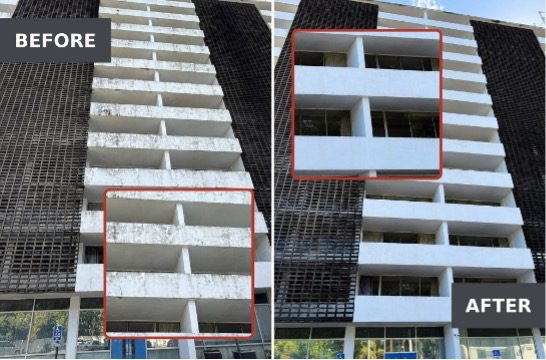
Do Cleaning Drones Actually Work? 15 Apellix Before-and-After Jobs Show the Results

What Is the Best Commercial Cleaning Drone in 2026? Specs, Prices, and a Head-to-Head Comparison

Inspired Flight Gremsy IF800 VIO F1 drones geo week

What Will It Take to Strengthen U.S. Drone Manufacturing? A Conversation with Inspired Flight’s CEO

Global Mapper Mobile data collection

Collection Ground Control Points with Global Mapper Mobile

Military Drone Mapping Solutions

How SimActive’s Correlator3D™ is Revolutionizing Military Mapping: An Exclusive Interview with CEO Philippe Simard

Photogrammetry Accuracy Standards

SimActive Photogrammetry Software: Enabling Users to Meet Accuracy Standards for Over 20 Years

About Us | Contact Us | Advertise With Us | Write for Us | Privacy Policy | Terms of Service

The Trusted Source for the Business of Drones.

This website uses cookies and third party services. By clicking OK, you are agreeing to our privacy policy. ACCEPT

Manage consent

Privacy Overview

This website uses cookies to improve your experience while you navigate through the website. Out of these, the cookies that are categorized as necessary are stored on your browser as they are essential for the working of basic functionalities of the website. We also use third-party cookies that help us analyze and understand how you use this website. These cookies will be stored in your browser only with your consent. You also have the option to opt-out of these cookies. But opting out of some of these cookies may affect your browsing experience.
Necessary
Always Enabled
Necessary cookies are absolutely essential for the website to function properly. These cookies ensure basic functionalities and security features of the website, anonymously.
CookieDurationDescription
cookielawinfo-checkbox-analytics11 monthsThis cookie is set by GDPR Cookie Consent plugin. The cookie is used to store the user consent for the cookies in the category "Analytics".
cookielawinfo-checkbox-functional11 monthsThe cookie is set by GDPR cookie consent to record the user consent for the cookies in the category "Functional".
cookielawinfo-checkbox-necessary11 monthsThis cookie is set by GDPR Cookie Consent plugin. The cookies is used to store the user consent for the cookies in the category "Necessary".
cookielawinfo-checkbox-others11 monthsThis cookie is set by GDPR Cookie Consent plugin. The cookie is used to store the user consent for the cookies in the category "Other.
cookielawinfo-checkbox-performance11 monthsThis cookie is set by GDPR Cookie Consent plugin. The cookie is used to store the user consent for the cookies in the category "Performance".
viewed_cookie_policy11 monthsThe cookie is set by the GDPR Cookie Consent plugin and is used to store whether or not user has consented to the use of cookies. It does not store any personal data.
Functional
Functional cookies help to perform certain functionalities like sharing the content of the website on social media platforms, collect feedbacks, and other third-party features.
Performance
Performance cookies are used to understand and analyze the key performance indexes of the website which helps in delivering a better user experience for the visitors.
Analytics
Analytical cookies are used to understand how visitors interact with the website. These cookies help provide information on metrics the number of visitors, bounce rate, traffic source, etc.
Advertisement
Advertisement cookies are used to provide visitors with relevant ads and marketing campaigns. These cookies track visitors across websites and collect information to provide customized ads.
Others
Other uncategorized cookies are those that are being analyzed and have not been classified into a category as yet.
SAVE & ACCEPT