SimActive, a Montreal-based photogrammetry software company with over 20 years serving the mapping community. From satellites to aircraft and drones, one software for all acquisition platforms, designed to support all sizes of professional photogrammetry providers.
Accuracy standards are crucial in promoting consistency, reliability, and quality in the geospatial data we deliver. However, these standards may vary based on local governing bodies, municipalities, governmental departments and so on. Additionally, as technology improves, these standards may occasionally change.
Ultimately, it comes down to the end-user the data are captured and delivered to, but they often themselves may need to be educated as well. This is where the data provider becomes the facilitator in the process. Knowing what kind of resolution and accuracy can be provided with the tools available, conveying that information to the customer and assisting in them determining what they may need.
One of the biggest challenges today is the anxiousness of new entrants into the mapping business, especially with drones to oversell technology as a differentiator. Flying lower, with a higher resolution camera does not necessarily correlate to higher accuracy. Neither does a drone with a RTK or PPK solution if not coupled with a highly accurate/ military grade IMU.
Every project should include ground survey, without it there is no way to establish and validate high-accuracy mapping deliverables. If no one is available in-house to collect GCPs, then a local surveyor should be hired. Having surveyors collect additional GCP’s will always be cheaper than having to re-mobilize and potentially re-fly because not enough was collected initially.

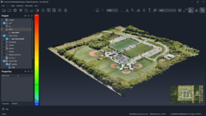
Once the imagery is captured, and GCP’s are available, higher-end photogrammetry software such as SimActive’s Correlator3D can be used to create and validate mapping deliverables. Quality reports generated during aerial triangulation, users can determine if the mapping deliverables meet the client’s accuracy requirements, share this information with them or reformat the results into an accuracy report/statement of their choosing.
More information on meeting accuracy standards can be found here.
Read more:
- Enhancing Photogrammetry Accuracy with Advanced GCPs Integration by SimActive and CompassData
- Revolutionizing 3D Mapping: SimActive’s Integration with Multi-Camera Drone Payloads
- SimActive Enhances Cloud Productivity with Correlator3D Upgrade
- SimActive Releases New Version of Correlator 3D: Point Clouds and DSMs, Generated Twice as Fast
Miriam McNabb is the Editor-in-Chief of DRONELIFE and CEO of JobForDrones, a professional drone services marketplace, and a fascinated observer of the emerging drone industry and the regulatory environment for drones. Miriam has penned over 3,000 articles focused on the commercial drone space and is an international speaker and recognized figure in the industry. Miriam has a degree from the University of Chicago and over 20 years of experience in high tech sales and marketing for new technologies.
For drone industry consulting or writing, Email Miriam.
TWITTER:@spaldingbarker
Subscribe to DroneLife here.