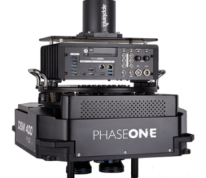
Correlator3D, known for its ability to handle various imagery sources, now accommodates both small sensors like the IXM-50 commonly used in drones and larger ones like the PAS 880i NIR with oblique and nadir systems for citywide mapping. This adaptability positions SimActive as a key player in aerial imaging software.
Correlator3D features seamless import of large projects in Phase One’s native IIQ format. This eliminates the need for converting data to TIF, reducing project setup time, which is particularly advantageous when dealing with extensive datasets. The processing workflow remains consistent across different sensor sizes.
Correlator3D generates a range of outputs, including Digital Surface Models (DSMs), Digital Terrain Models (DTMs), point clouds, orthomosaics, and 3D meshes.
Kevin Graville, System Sales Manager at Phase One, commented on the collaboration, stating, “The ability to seamlessly import our native IIQ format shows that SimActive’s software effectively uses our 16-bit data. Correlator3D’s capability to handle extensive datasets aligns with our clients’ expectations.”
SimActive’s Correlator3D streamlines the workflow for Phase One camera users and enhances data processing in the aerial imaging industry. This collaboration elevates both SimActive’s position as a technology provider and Phase One cameras’ capabilities.
Don’t miss SimActive and Phase One’s upcoming webinar, this Thursday August 17. Offered at multiple times to accommodate users all over the world, Cameras on Drones and Aircraft: Is Bigger Always Better? features guest speaker Kevin Graville, System Sales Manager at Phase One. Register here.
Missed the webinar? Visit SimActive.com to watch the recording.
Read more:
- SimActive Goes Big: Lower Pricing for Processing Data From Larger Drone Cameras
- Meeting Photogrammetric Accuracy Standards: Free Webinar from SimActive, with Specialist from DAS Geospatial
- Meet the Two Brothers Behind a Visionary Mapping Platform: SimActive Celebrates 20 Years with a New Version of Correlator 3D
- Colorizing Lidar: SimActive and LiDARUSA Partner
- From the floor of Intergeo: Simactive, Mapping Spaces from Countries to Construction Sites

Miriam McNabb is the Editor-in-Chief of DRONELIFE and CEO of JobForDrones, a professional drone services marketplace, and a fascinated observer of the emerging drone industry and the regulatory environment for drones. Miriam has penned over 3,000 articles focused on the commercial drone space and is an international speaker and recognized figure in the industry. Miriam has a degree from the University of Chicago and over 20 years of experience in high tech sales and marketing for new technologies.
For drone industry consulting or writing, Email Miriam.
TWITTER:@spaldingbarker
Subscribe to DroneLife here.