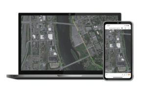
 At last week’s INTERGEO show in Essen, Germany, companies from around the world showcased mapping tools from new drone hardware to new mapping software. We met with our friends at Blue Marble Geographics to see what the newest version of Blue Marble Global Mapper has to offer for customers.
Cintia Miranda, Blue Marble Marketing Manager and Mackenzie Mills, Associate Product Manager, said that being out at INTERGEO to showcase the newest version was a welcome relief after several years of limited travel due to the pandemic. “About half of our sales are overseas,” says Cintia Miranda. “Europe is our second largest market. We’re happy to be back after 2 years, glad to see users and new customers – and to see what our competitors have to offer.”
The Newest Applications and Use Cases for GIS Solutions
GIS products are being used more than ever before to solve the critical problems facing the world. “In going around we are seeing many applications that have to do with climate change,” says Mackenzie. GIS companies are using new tools and new sensors to measure the effects of climate change on every type of terrain. Special products and projects for documenting, analyzing, and assessing change in waterways, ocean beaches, aquatic wildlife, forests, deserts, mountains and more were on display at INTERGEO. At Blue Marble, their GIS products have been used for monitoring forest change and watershed analysis: don’t miss full descriptions of these projects here.
Blue Marble Global Mapper v. 24
Global Mapper is a sophisticated GIS product that offers a comprehensive range of data processing tools (check them out here). As the release number indicates, the product has been continually refined for more than 20 years – and now is an easy to use, feature-rich application for any level of GIS professional.
Blue Marble’s Geographics products are used by some of the biggest company names in the world: Exxon, Chevron, GM, National Geographic, and more. Based in Maine, Blue Marble started in 1993, acquiring Global Mapper in 2011. Mackenzie Mills explained that the team was showcasing v24 of their signature Global Mapper product. “V24 offers advanced 3D and vector graphics features, with better resolution and speed,” she says.
Read more about Blue Marble:
- Global Mapper Mobile: New GNSS Device Support
- Drone Mapping: Global Mapper Mobile New Features Mean Higher Accuracy Data Collection
CEO DroneLife.com, DroneRacingLife.com, and CMO of Jobfordrones.com. Principle at Spalding Barker Strategies. Has enjoyed working with and around the commercial drone industry for the last 10 years. Attendance and speaker at Industry Events such as Commercial UAV, InterGeo, Interdrone and others. Proud father of two. Enjoys karate, Sherlock Holmes, and interesting things. Subscribe to all things drone at DroneLife here. Email is Harry@dronelife.com. Make Sure that you WhiteList us in your email to make sure you get our Newsletter. Editor1@dronelife.com.


[…] More… […]