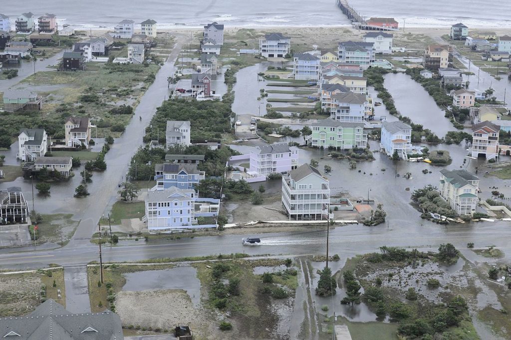
 Hurricane Matthew has hit hard, causing severe damage and flooding in Jamaica, Haiti, and the US. As disaster response teams work to coordinate relief efforts, some teams will be using drones – an effective new tool in dealing with extreme weather. Here are 5 ways that drones help us to deal with hurricanes:
- Drones help us to predict extreme weather more accurately – and better understand what’s happening. Drones are heavily used by NOAA to monitor weather patterns, and new research shows that drones have unique capabilities in assisting us to monitor and research extreme events like hurricanes and tornadoes. The University of Colorado Boulder is the lead research institution on a 1.9 million dollar federal grant to develop drones designed to provide enhanced monitoring and data-based research of severe storms: the project, named “Severe-Storm Targeted Observation and Robotic Monitoring” or “STORM” is working to expand drones’ ability to collect data during extreme weather events.
- Drones are the best tools for search and rescue operations. Without a doubt, drones are among the very best tools for performing search and rescue operations and saving lives. Recent research proves that times is cut drastically and outcomes improved using drones. During this year’s flooding in Chennai, for example, drones were used as part of a communications system sending the nearest rescue teams directly to specified locations where a rescue was identified by drone, replacing a time consuming house by house search. Drone operators in Louisiana spent days flying over streets and neighborhoods helping people to confirm that their loved ones were safe during this year’s flood – and a veteran flying a Phantom drone recently was able to save the life of a Carolina man trapped inside of his suburban home, which was nearly submerged due to Hurricane Matthew.
- Drones provide accurate, fast and thorough documentation for insurance claims. After the hurricane, homeowners need a way of documenting damage – and drones provide one of the best ways of doing so. Insurance companies are now accustomed to receiving drone footage which can indicate the extent of flooding on the property, roof damage, and the condition of the surrounding neighborhood – all with a few aerial images. And with experienced operators using thermography and photogrammetry, construction engineers can identify exactly where structures sustained damage.
- Using drones and 3D Mapping, response teams can quickly evaluate changes in the road system or landscape. Following earthquakes in Nepal, DJI and mapping company Pix4D joined forces to create 3D maps of damaged landscapes. This type of map can be used after disasters to inform the rebuilding efforts of major infrastructure such as roads and bridges and can show response teams how the landscape may have changed or shifted as the result of extreme weather.
- Drones are the best tools for monitoring infrastructure – like energy plants – immediately after a storm. While drones can’t fly in the worst of the winds, they are one of the best tools available for monitoring the health of infrastructure like energy plants and off-shore oil production facilities immediately after a disaster, even well before the area may be safe for people to access.
In the future, as regulations evolve to allow drone delivery, drones could be used to delivery clean water and food. Drone delivery company Flirtey has already successfully tested ship-to-shore delivery of medical supplies. In a situation like disaster struck Haiti, where residents of the Southern department have been cut off from food and clean water supplies in Port-au-Prince, rescue ships could launch drones to the shore to deliver much needed supplies.

Miriam McNabb is the Editor-in-Chief of DRONELIFE and CEO of JobForDrones, a professional drone services marketplace, and a fascinated observer of the emerging drone industry and the regulatory environment for drones. Miriam has penned over 3,000 articles focused on the commercial drone space and is an international speaker and recognized figure in the industry. Miriam has a degree from the University of Chicago and over 20 years of experience in high tech sales and marketing for new technologies.
For drone industry consulting or writing, Email Miriam.
TWITTER:@spaldingbarker
Subscribe to DroneLife here.


[…] of the largest insurers are processing millions of property claims following Hurricane Matthew more efficiently by using […]