• Skip to main content
  • Skip to secondary menu
  • Skip to primary sidebar
  • Skip to secondary sidebar
  • Skip to footer
  • DroneRacingLife
  • DroneFlyers
  • Newsletter
DroneLife

DRONELIFE

Stay up to date on all the latest Drone News

  • News
  • Products
  • Industries
    • Agriculture
    • Construction
    • Delivery
    • Dual Use
    • Inspection
    • Public Safety
    • Surveying
  • Enthusiasts
  • Regulations
  • Business
  • Video
  • Podcasts

Police Forces Use Drones to Investigate Road Accidents

April 24, 2016 by Frank Schroth Leave a Comment

Guest post by Julio Ventura, DronesGlobe —

Aeryon screen shotIt is no surprise that drones have changed the way the world operates. Unmanned Aerial Vehicles (UAVs) have introduced new ways to address a variety of problems. These technological developments are not restricted to military and commercial use. One area of impact is safety and security. UAVs have the capability of speeding up investigations and analyses, since drones are able to cover a much bigger area with their cameras and don’t face the problem of road traffic. With this in mind Portugal has been making some advancements in this area, namely PSP (Public Security Police) of Vila Real together with Trás-os-Montes and Alto Douro Universities.

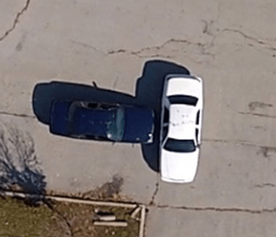
These three identities have been developing an innovative project: a method to investigate road accidents using small and lightweight drones packed with High-Definition cameras. The current method of investigating a road accident requires many posted police agents, hours of blocked roads and slow traffic. Consequently a better and faster solution is needed. The aim is to record aerial footage from the accident within minutes, after gathering necessary footage the scene can be efficiently reconstructed afterwards. This prevents extended road blockage and reduces the time needed for measurements. An agent of Vila Real Police said, “Such an image is much more useful for scene reconstruction in court than the sketches drawn by the agent responsible for the incident”. The first drone tests were conducted a week ago but there is not yet a deadline for a definitive implementation of this new method.

The method is not unique to Portugal. Canada based company Aeryon Labs has also been developing drones aimed at this specific task. In fact, they have already released products, namely Scout and SkyRanger, already are available in this high-budget market, prices range between $65,000 and $120,000. Business reporter Vanessa Lu of the Toronto Star writes, “drivers stuck in a traffic jam when a highway closes due to a serious traffic collision in the Greater Toronto Area may be surprised to learn these devices, which police officers insist on calling UAVs, unmanned aerial vehicles, are already being used to help clear accident scenes.” The Ontario Provincial Police has already invested in three of these Aeryon Labs drones for highway safety and emergencies. Area traffic Sergeant Brad Muir for OPP’s highway safety division said: “Because scenes can be so big, we can map the whole scene .  .  . We try to deploy them as much as possible because we know the impact of a highway closure.” A quick response and accurate data reduce the mapping time from the average 2 hours to 15 minutes and provide backups for further analyses if needed. Although bad weather conditions prevent the deployment of these UAVs it still is a reliable time and money saver for the government.

The rapid development of the drone industry is providing new and exciting applications. The possibilities are endless. FAA Reauthorization being approved by the U.S. Senate Committee on Commerce, Science and Transportation this has opened a wide set of new possibilities to the U.S. such as the road accident investigation. The society awaits as the world learns how to deal with this new aerial technology, the future is bright and promising.

Frank Schroth
Frank Schroth

Frank Schroth is editor in chief of DroneLife, the authoritative source for news and analysis on the drone industry: it’s people, products, trends, and events.
Email Frank
TWITTER:@fschroth

Filed Under: Fire and Police, News, Selected – Safety and Security Tagged With: Aeryon Labs

Reader Interactions

Leave a Reply Cancel reply

Your email address will not be published. Required fields are marked *

Primary Sidebar

LATEST

From Missions to Management: The Shift Defining Public Safety Drone Programs [DRONELIFE Exclusive Interview]

As public safety drone use scales, data, compliance, and coordination define success Public safety drone programs have reached an inflection…

Continue Reading From Missions to Management: The Shift Defining Public Safety Drone Programs [DRONELIFE Exclusive Interview]

Can One Drone Safely Stop Another? Vector and Wrap Think So

Vector teams with Wrap to create killer-drone system By DRONELIFE Features Editor Jim Magill Vector, a Utah-based technology company that…

Continue Reading Can One Drone Safely Stop Another? Vector and Wrap Think So

American Drone Network and BRANDT Partner to Advance Agricultural Drone Spraying

Collaboration focuses on improving application efficiency, product performance, and pilot training American Drone Network (ADN) has announced a new partnership…

Continue Reading American Drone Network and BRANDT Partner to Advance Agricultural Drone Spraying

Honeywell and Odys Aviation Introduce Airborne Layer for Counter-UAS Defense

New system highlights the need for layered protection against evolving drone threats As drone threats continue to evolve, defense strategies…

Continue Reading Honeywell and Odys Aviation Introduce Airborne Layer for Counter-UAS Defense

The Real FCC Drone Debate: Who Controls the Airwaves?

A closer look at how spectrum policy and licensing could determine the future of U.S. drone operations The FCC is…

Continue Reading The Real FCC Drone Debate: Who Controls the Airwaves?

Why Japan’s AAM Roadmap May Be the Most Realistic in the World

A phased, system-wide approach focuses on operations, infrastructure, and public acceptance Japan’s leading AAM provider, SkyDrive, has translated the country’s…

Continue Reading Why Japan’s AAM Roadmap May Be the Most Realistic in the World

DroneShield Opens European Headquarters in Amsterdam Amid Growing Counter-Drone Demand

DroneShield has officially opened its new European headquarters in Amsterdam, The Netherlands. The move strengthens the counter-drone company’s operational presence…

Continue Reading DroneShield Opens European Headquarters in Amsterdam Amid Growing Counter-Drone Demand

Mid-America Transplant Opens 160-Mile Drone Corridor for Organ Donation

Mid-America Transplant has become the first organ procurement organization (OPO) in the United States to use drones for donor blood…

Continue Reading Mid-America Transplant Opens 160-Mile Drone Corridor for Organ Donation

Manna Raises $50M to Expand Drone Delivery Network in the U.S.

Funding supports plans for 40 new bases and continued scaling of suburban UAV delivery operations Manna Air Delivery has announced…

Continue Reading Manna Raises $50M to Expand Drone Delivery Network in the U.S.

Terra Drone Invests in Ukraine-Based Interceptor Drone Company, Launches Terra A1

Partnership aims to scale low-cost defense solutions and expand global unmanned systems capabilities Terra Drone Corporation has announced a strategic…

Continue Reading Terra Drone Invests in Ukraine-Based Interceptor Drone Company, Launches Terra A1

Secondary Sidebar

Footer

SPONSORED

Inspired Flight Gremsy IF800 VIO F1 drones geo week

What Will It Take to Strengthen U.S. Drone Manufacturing? A Conversation with Inspired Flight’s CEO

Global Mapper Mobile data collection

Collection Ground Control Points with Global Mapper Mobile

Military Drone Mapping Solutions

How SimActive’s Correlator3D™ is Revolutionizing Military Mapping: An Exclusive Interview with CEO Philippe Simard

Photogrammetry Accuracy Standards

SimActive Photogrammetry Software: Enabling Users to Meet Accuracy Standards for Over 20 Years

NACT Engineering Parrot ANAFI tether indoor shot

Smart Tether for Parrot ANAFI USA from NACT Engineering

Blue Marble, features global mapper, features Blue Marble

Check Out These New Features in Global Mapper v25 from Blue Marble

About Us | Contact Us | Advertise With Us | Write for Us | Privacy Policy | Terms of Service

The Trusted Source for the Business of Drones.

This website uses cookies and third party services. By clicking OK, you are agreeing to our privacy policy. ACCEPT

Manage consent

Privacy Overview

This website uses cookies to improve your experience while you navigate through the website. Out of these, the cookies that are categorized as necessary are stored on your browser as they are essential for the working of basic functionalities of the website. We also use third-party cookies that help us analyze and understand how you use this website. These cookies will be stored in your browser only with your consent. You also have the option to opt-out of these cookies. But opting out of some of these cookies may affect your browsing experience.
Necessary
Always Enabled
Necessary cookies are absolutely essential for the website to function properly. These cookies ensure basic functionalities and security features of the website, anonymously.
CookieDurationDescription
cookielawinfo-checkbox-analytics11 monthsThis cookie is set by GDPR Cookie Consent plugin. The cookie is used to store the user consent for the cookies in the category "Analytics".
cookielawinfo-checkbox-functional11 monthsThe cookie is set by GDPR cookie consent to record the user consent for the cookies in the category "Functional".
cookielawinfo-checkbox-necessary11 monthsThis cookie is set by GDPR Cookie Consent plugin. The cookies is used to store the user consent for the cookies in the category "Necessary".
cookielawinfo-checkbox-others11 monthsThis cookie is set by GDPR Cookie Consent plugin. The cookie is used to store the user consent for the cookies in the category "Other.
cookielawinfo-checkbox-performance11 monthsThis cookie is set by GDPR Cookie Consent plugin. The cookie is used to store the user consent for the cookies in the category "Performance".
viewed_cookie_policy11 monthsThe cookie is set by the GDPR Cookie Consent plugin and is used to store whether or not user has consented to the use of cookies. It does not store any personal data.
Functional
Functional cookies help to perform certain functionalities like sharing the content of the website on social media platforms, collect feedbacks, and other third-party features.
Performance
Performance cookies are used to understand and analyze the key performance indexes of the website which helps in delivering a better user experience for the visitors.
Analytics
Analytical cookies are used to understand how visitors interact with the website. These cookies help provide information on metrics the number of visitors, bounce rate, traffic source, etc.
Advertisement
Advertisement cookies are used to provide visitors with relevant ads and marketing campaigns. These cookies track visitors across websites and collect information to provide customized ads.
Others
Other uncategorized cookies are those that are being analyzed and have not been classified into a category as yet.
SAVE & ACCEPT