
• Skip to main content
  • Skip to secondary menu
  • Skip to primary sidebar
  • Skip to secondary sidebar
  • Skip to footer
  • DroneRacingLife
  • DroneFlyers
  • Newsletter
DroneLife

DRONELIFE

Stay up to date on all the latest Drone News

  • News
  • Products
  • Industries
    • Agriculture
    • Construction
    • Delivery
    • Dual Use
    • Inspection
    • Public Safety
    • Surveying
  • Enthusiasts
  • Regulations
  • Business
  • Video
  • Podcasts

Archaeologist ‘Digs’ Using Drone for Fieldwork in Armenia

September 3, 2014 by Alan Phillips Leave a Comment

from technology.org

A Purdue University archaeologist is utilizing drone technology to capture details and data from Bronze Age field sites in Armenia.

“Drones are a new tool in archaeologists’ toolkits,” said Ian Lindsay, an associate professor of anthropology who has been excavating in the South Caucasus region for 15 years. “It’s a good alternative to kites, balloons or sitting in the bucket of a crane with a camera trying to visually document these ancient sites. Drones offer a detailed aerial perspective that we’ve never had before, and by leveraging this technology archaeologists can be more efficient in the field as drones give us an immediate sense of spatial science scale useful for planning excavation.”

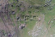
Lindsay’s 3:49 minute video of various field Armenian sites from this summer is available online. The drone, flying 300 meters from the ground, navigated the valleys and mountains of the Tsaghkahovit Plain and Mt. Aragats region to provide a view that is better quality and less expensive than images captured by satellite or mapping imagery. Lindsay is co-director of Project ArAGATS, Archaeology and Geography of Ancient Transcaucasian Societies, that focuses on the exploration of southern Caucasia’s rich past and the preservation of modern Armenia’s diverse cultural heritage.

Funds from Purdue’s College of Liberal Arts and Office of Executive Vice President for Research and Partnerships supported the new drone technology. Lindsay also is collaborating with Adam T. Smith, Cornell University professor and co-director of the Project ArAGATS, and the Aragats Foundation, which encourages and supports archaeological tourism, education and development in Armenia.

In addition to the spatial analysis of the hilly region, Lindsay also was able to use the drone images to count burials from the late Late Bronze Age, dating to 1500 BCE, a time period contemporary to King Tut in Egypt.

The societies of the South Caucasia society were mobile – pastoralists who cared for livestock – so they didn’t leave a strong footprint other than cemeteries and fortresses which may have housed their leaders. These fortresses were built with extremely large stone boulders and on ridges overlooking plains and valleys. Because only the lower courses of the foundation walls are preserved, researchers do not know the height of the structures. Ancient remains and artifacts, including a shrine enclosed within a stone room of a fortress, can be found up to 2 meters underground, but there are some visible surface features.

“I’m interested in how mobile pastoralists coalesce into larger political structures,” Lindsay said. “This group was mobile, so what brought them back to these fortresses to pay their tithing and support the local political structure? Artifacts show these places were homes to ritual, and ritual is an important form of soft power that may have encouraged people to return seasonally to support the fortresses’ institutions and leaders.”

Lindsay also is interested in the development of metal production in the area, as well as trade and communication routes through the hilly region.

In addition to utilizing the drone technology this summer, Lindsay was able to test a new iPad-based mobile GIS (geographic information system) data collection system and mobile data collection app that he and Nicole Kong, an assistant professor of library science who specializes in GIS, developed to inventory new sites.

“This will be a collaborative tool for archaeologists in the region to add and edit data about field sites,” Lindsay said. “It also will be helpful to update legacy sites, which are sites that were identified or excavated but have not yet been published. Again, it’s another tool to help scientists be more efficient in the field.”

Continue Reading at technology.org…

Alan Phillips
Alan Phillips

Alan is serial entrepreneur, active angel investor, and a drone enthusiast. He co-founded DRONELIFE.com to address the emerging commercial market for drones and drone technology. Prior to DRONELIFE.com, Alan co-founded Where.com, ThinkingScreen Media, and Nurse.com. Recently, Alan has co-founded Crowditz.com,  a leader in Equity Crowdfunding Data, Analytics, and Insights.  Alan can be reached at alan(at)dronelife.com

Filed Under: Drones in the News, Education Tagged With: Archeology, Armenia, Purdue University

Reader Interactions

Leave a Reply Cancel reply

Your email address will not be published. Required fields are marked *

Primary Sidebar

LATEST

The Drone Is No Longer the Point

At INTERGEO, attention has shifted from individual platforms to complete geospatial workflows. One of the clearest drone industry trends at…

Continue Reading The Drone Is No Longer the Point

FCC Clears Nationwide Test of Cellular Networks for Drone Safety

Temporary waiver will allow DOT to measure airborne wireless coverage for command and control, detect and avoid, Remote ID and…

Continue Reading FCC Clears Nationwide Test of Cellular Networks for Drone Safety

From Cars to Drones: Birdstop Taps Detroit’s Auto Supply Chain to Scale U.S. Manufacturing

UAV maker turns to auto industry as source of domestic components By DRONELIFE Features Editor Jim Magill While Silicon Valley…

Continue Reading From Cars to Drones: Birdstop Taps Detroit’s Auto Supply Chain to Scale U.S. Manufacturing

Wingcopter 262 Debuts as All-Electric Tactical Reconnaissance eVTOL for Defense Users

The all-electric Wingcopter 262 carries a 262-centimeter (103-inch) wingspan, a 150-kilometer (93-mile) tactical range and a 10-kilogram (22-pound) maximum takeoff…

Continue Reading Wingcopter 262 Debuts as All-Electric Tactical Reconnaissance eVTOL for Defense Users

Kite Aero Commences KITE UAS Production in Geelong

Sovereign Five Eyes aligned production of the KITE autonomous logistics aircraft moves to Sykes’ composite facility as the company builds…

Continue Reading Kite Aero Commences KITE UAS Production in Geelong

They Predicted a $127 Billion Drone Market. Ten Years Later, Here’s What They Got Right.

In 2016, Michael Mazur and Adam Wiśniewski helped author one of the drone industry’s most widely cited forecasts, putting the…

Continue Reading They Predicted a $127 Billion Drone Market. Ten Years Later, Here’s What They Got Right.

Beyond the Drone: What to See at INTERGEO 2026 in Munich

DRONELIFE heads to INTERGEO for a look at the mapping, lidar, photogrammetry, AI and digital twin technologies shaping the next…

Continue Reading Beyond the Drone: What to See at INTERGEO 2026 in Munich

Can Your Drone Program Survive Success? Why Simplicity Matters at Scale

SkyeBrowse CEO Bobby Ouyang says growing drone programs face a new challenge: making sophisticated capabilities simple enough to use across…

Continue Reading Can Your Drone Program Survive Success? Why Simplicity Matters at Scale

Batteries Were Boring. That Was a Feature. It’s Gone.

The shift toward a more secure domestic drone supply chain is forcing manufacturers to rethink components they once took for…

Continue Reading Batteries Were Boring. That Was a Feature. It’s Gone.

UK-Mined Lithium Passes Battery Test as Nations Push to Secure Critical Mineral Supply Chains

Cornish Lithium says lithium hydroxide produced and refined in Cornwall performed in line with, and in some areas better than,…

Continue Reading UK-Mined Lithium Passes Battery Test as Nations Push to Secure Critical Mineral Supply Chains

Secondary Sidebar

Footer

SPONSORED

What Is the Best Commercial Cleaning Drone in 2026? Specs, Prices, and a Head-to-Head Comparison

Inspired Flight Gremsy IF800 VIO F1 drones geo week

What Will It Take to Strengthen U.S. Drone Manufacturing? A Conversation with Inspired Flight’s CEO

Global Mapper Mobile data collection

Collection Ground Control Points with Global Mapper Mobile

Military Drone Mapping Solutions

How SimActive’s Correlator3D™ is Revolutionizing Military Mapping: An Exclusive Interview with CEO Philippe Simard

Photogrammetry Accuracy Standards

SimActive Photogrammetry Software: Enabling Users to Meet Accuracy Standards for Over 20 Years

NACT Engineering Parrot ANAFI tether indoor shot

Smart Tether for Parrot ANAFI USA from NACT Engineering

About Us | Contact Us | Advertise With Us | Write for Us | Privacy Policy | Terms of Service

The Trusted Source for the Business of Drones.

This website uses cookies and third party services. By clicking OK, you are agreeing to our privacy policy. ACCEPT

Manage consent

Privacy Overview

This website uses cookies to improve your experience while you navigate through the website. Out of these, the cookies that are categorized as necessary are stored on your browser as they are essential for the working of basic functionalities of the website. We also use third-party cookies that help us analyze and understand how you use this website. These cookies will be stored in your browser only with your consent. You also have the option to opt-out of these cookies. But opting out of some of these cookies may affect your browsing experience.
Necessary
Always Enabled
Necessary cookies are absolutely essential for the website to function properly. These cookies ensure basic functionalities and security features of the website, anonymously.
CookieDurationDescription
cookielawinfo-checkbox-analytics11 monthsThis cookie is set by GDPR Cookie Consent plugin. The cookie is used to store the user consent for the cookies in the category "Analytics".
cookielawinfo-checkbox-functional11 monthsThe cookie is set by GDPR cookie consent to record the user consent for the cookies in the category "Functional".
cookielawinfo-checkbox-necessary11 monthsThis cookie is set by GDPR Cookie Consent plugin. The cookies is used to store the user consent for the cookies in the category "Necessary".
cookielawinfo-checkbox-others11 monthsThis cookie is set by GDPR Cookie Consent plugin. The cookie is used to store the user consent for the cookies in the category "Other.
cookielawinfo-checkbox-performance11 monthsThis cookie is set by GDPR Cookie Consent plugin. The cookie is used to store the user consent for the cookies in the category "Performance".
viewed_cookie_policy11 monthsThe cookie is set by the GDPR Cookie Consent plugin and is used to store whether or not user has consented to the use of cookies. It does not store any personal data.
Functional
Functional cookies help to perform certain functionalities like sharing the content of the website on social media platforms, collect feedbacks, and other third-party features.
Performance
Performance cookies are used to understand and analyze the key performance indexes of the website which helps in delivering a better user experience for the visitors.
Analytics
Analytical cookies are used to understand how visitors interact with the website. These cookies help provide information on metrics the number of visitors, bounce rate, traffic source, etc.
Advertisement
Advertisement cookies are used to provide visitors with relevant ads and marketing campaigns. These cookies track visitors across websites and collect information to provide customized ads.
Others
Other uncategorized cookies are those that are being analyzed and have not been classified into a category as yet.
SAVE & ACCEPT




