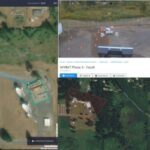
Verizon is dialing up a new mission for its drone subsidiary – wildfire damage inspection. The telecom announced today the FAA granted Portland-based Skyward a temporary waiver allowing company pilots to fly Percepto Sparrow drones from their homes to inspect critical communications infrastructure near the Big Hollow wildfire in Washington. So far, the blaze has consumed … [Read more...] about FAA OKs Wildfire Drone Inspections for Verizon’s Skyward
Wildfires
Drone Spotted Over Arizona Wildfire, Forcing Setback
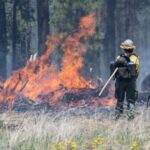
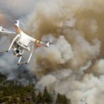
Safety officials across the country continue to warn drone users “Don’t fly aircraft over wildfires.” This week, Arizona State Forestry officials spotted a drone over the Coldwater fire – a blaze that has burned more than 6,000 acres of the Coconino National Forest since being sparked by a lightning strike on May 30. On Saturday, a flight coordinator saw a drone flying … [Read more...] about Drone Spotted Over Arizona Wildfire, Forcing Setback
NOAA Partners with Drone Firm To Forecast Wildfires
The National Oceanic and Atmospheric Administration is taking swift steps to predict wildfires by partnering with a drone firm. Colorado-based Black Swift Technologies recently announced the drone deal – the deployment of “a tightly integrated system consisting of an airframe, avionics, and multiple sensors capable of research-quality measurements of CO2, CO, aerosol, [and … [Read more...] about NOAA Partners with Drone Firm To Forecast Wildfires
US Gov Partners with DJI, Drone Industry
The US Department of the Interior has announced a collaboration with industry partners DJI, AirMap, and Skyward in an attempt to keep drones away from wildfires. In an announcement yesterday, the US Department of the Interior (DOI) says that they have released a prototype warning system with industry partners to provide real-time alerts and geofencing alarms to drone … [Read more...] about US Gov Partners with DJI, Drone Industry
AirMap, DJI Team Up to Corral Drone Wildfire Flights
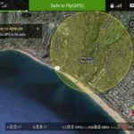
A California-based company has teamed up with the world’s largest drone manufacturer to build an anti-drone fence around wildfires. AirMap, a provider of UAV airspace intelligence and navigation services, announced a partnership last week with DJI to enhance its current geofencing data database to include areas experiencing wildfires. Errant drones have become a real … [Read more...] about AirMap, DJI Team Up to Corral Drone Wildfire Flights


