Don’t miss the latest edition of the new drone podcast from DRONELIFE, Weekly Wings! Drone Industry Issues from the pilot perspective. In this episode of Weekly Wings, we take a journey into the fascinating world of drone technology and its applications in unique and impactful ways. Join Samuel, Terry, and Paul as they delve into a groundbreaking drone inspection conducted … [Read more...] about Drones, Trees, and Teledyne FLIR: This Episode of Weekly Wings!
Thermal Imaging
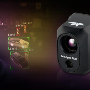
Teledyne FLIR Introduces New Hadron 640 Series for Enhanced Unmanned Systems Integration
Next-Generation Dual Thermal-Visible Cameras Optimized for Performance and Efficiency Teledyne FLIR, a division of Teledyne Technologies Incorporated, has unveiled its latest iteration of high-performance Hadron 640 dual radiometric thermal and visible camera modules. The newly released ITAR-free Hadron 640+ and radiometric Hadron 640R+ are designed to offer enhanced thermal … [Read more...] about Teledyne FLIR Introduces New Hadron 640 Series for Enhanced Unmanned Systems Integration
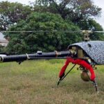
UAVOS Introduces Unpiloted Helicopter for Wildfire Suppression
The UVH-170 Drone: A Step Forward in Aerial Surveillance for Firefighting Autonomous UAV developer UAVOS recently announced that their UVH-170 unpiloted helicopter was successfully used to support wildfire suppression efforts, including night operations. Utilizing its combination of visible-light and thermal imaging cameras, the UVH-170 provided vital real-time geospatial … [Read more...] about UAVOS Introduces Unpiloted Helicopter for Wildfire Suppression
Two Innovative Canadian Drone Companies Join Forces to Fight Kelowna Wildfires
As wildfires raged in Canada, two innovative Canadian drone companies joined forces to provide responders with critical aerial data. InDro Robotics and Spexi Geospatial deployed commercial off the shelf drones weighing less than 250 grams, using the Spexigon automation platform, to provide decision makers with rapid damage assessment information and thermal imagery identifying … [Read more...] about Two Innovative Canadian Drone Companies Join Forces to Fight Kelowna Wildfires
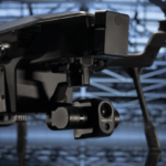
Teledyne FLIR’s New Drone: SIRAS™ Fills a Gap in the Industry
As Commercial UAV Expo gets started in Las Vegas, Teledyne FLIR, part of Teledyne Technologies Incorporated (NYSE:TDY), today launched SIRAS™, "a professional drone that includes a quick-connect dual radiometric thermal and visible camera payload." SIRAS fills a major gap in the industry right now - a professional drone with some of the best imaging available, from a major US … [Read more...] about Teledyne FLIR’s New Drone: SIRAS™ Fills a Gap in the Industry


