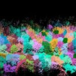
Routescene case study demonstrates the benefits of using drones to manage powerline vegetation. by DRONELIFE Staff Writer Ian M. Crosby The latest in a series of forestry based case studies conducted by Routescene showcases the value of remote sensing techniques like UAV LiDAR for identifying diseased or damaged trees and overgrown vegetation close to powerlines to … [Read more...] about Drones to Manage Powerline Vegetation: Routescene UAV LiDAR
Routescene
CHEESEHEAD Drone Project May Improve Climate Models
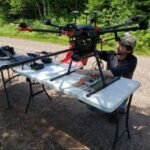
What do the Green Bay Packers and forest-scanning drones have in common? Cheeseheads. While Packer fans proudly identify with the dairy-infused moniker, a research project at the University of Wisconsin-Madison has adapted the name for a ground-breaking UAV project to improve weather forecasting by understanding how vegetation and forests influence the … [Read more...] about CHEESEHEAD Drone Project May Improve Climate Models
LiDAR Surveys by Drone: Increasing Flight Endurance for a Big Impact on Productivity
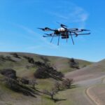
Used for creating precise 3D models of terrain for mapping and more, LiDAR surveys are an important commercial application for the drone industry - but battery limitations and the associated short flight times remain a problem. Now, California-based Skyfront is working with European UAV LiDAR solution provider Routescene to explore the impact of increasing flight endurance, … [Read more...] about LiDAR Surveys by Drone: Increasing Flight Endurance for a Big Impact on Productivity


