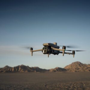
New Drones Enhance Mapping, Inspection, and Public Safety with AI Capabilities DJI has unveiled the Matrice 4 Series enterprise drones, featuring cutting-edge sensors, AI-powered tools, and a suite of capabilities aimed at improving aerial operations across various industries. The launch highlights DJI's ongoing innovation in drone technology, even as the U.S. government … [Read more...] about DJI Introduces Matrice 4 Series: Advanced Tools for Enterprise Drone Operations
Precision mapping
India’s IdeaForge Integrates Inertial Lab’s LiDAR into Commercial UAV Solutions
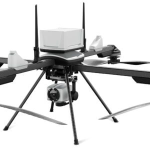
New Partnership Enhances UAV Mapping Capabilities ideaForge Technology Limited, an India-based global drone technology company, has announced a new partnership with Inertial Labs, a global leader in inertial sensors and GPS systems. This collaboration integrates Inertial Labs' RESEPI LiDAR solution into ideaForge's high-performance unmanned aerial vehicles (UAVs), representing … [Read more...] about India’s IdeaForge Integrates Inertial Lab’s LiDAR into Commercial UAV Solutions
SimActive Enhances Correlator3D with Multi-Camera System Compatibility
New Features to Boost Precision Mapping in Agriculture, Resource Management, and Construction Montreal-based photogrammetry software developers SimActive recently announced that its Correlator3D™ end-to-end software platform has added compatibility with multi-camera systems, allowing for a wider range of photogrammetry products. The additional sensors include oblique, … [Read more...] about SimActive Enhances Correlator3D with Multi-Camera System Compatibility
Marut Drones and NMDC Propel Indian Mineral Exploration into the Future with Innovative Drone Collaboration
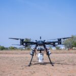
Marut Drones Collaborates with NMDC for Drone-Based Mineral Exploration in India Marut Drones, a prominent drone manufacturer in India, has partnered with the National Mineral Development Corporation (NMDC) to introduce drone-based mineral exploration in the country. This collaboration represents a significant advancement in the field, utilizing custom-designed drones with … [Read more...] about Marut Drones and NMDC Propel Indian Mineral Exploration into the Future with Innovative Drone Collaboration


