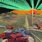
In a sign that the drone industry has reached a new phase in its evolution, drone companies are moving beyond drones. Photogrammetry solution provider Pix4D has launched Pix4Dcatch, a new app for getting ground images from iOS devices like iPads and iPhones. The new app means that operators can use both ground and aerial images - from manned or unmanned aircraft - to create … [Read more...] about Pix4Dcatch: Gather Ground Images for 3D Modeling with iOS Devices
Pix4D
ANAFI USA and Pix4D: Compatible to Create Complete Solutions
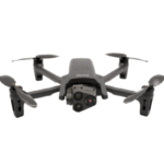
Parrot, the leading European drone group, and Pix4D, the leading professional photogrammetry and drone mapping software company, "are excited to announce the latest generation ANAFI USA drone is now compatible with the Pix4D software suite," says a Parrot press release. That's not a surprise, as Parrot owns 95% of Pix4D. It does indicate, however, that Parrot is realizing … [Read more...] about ANAFI USA and Pix4D: Compatible to Create Complete Solutions
Pix4D and Wingtra: New Integration Makes Orthomosaic and Point Cloud Generation 2X Faster
Wingtra's recent WingtraHub 1.0 release introduces a lean workflow between the WingtraOne drone and Pix4Dmatic, a "fresh Pix4D product for reliable speedy processing of large datasets," says a Wingtra press release. "This integration is especially key since Wingtra's VTOL drone is designed to map large sites fast and safely while providing the best possible data quality. The … [Read more...] about Pix4D and Wingtra: New Integration Makes Orthomosaic and Point Cloud Generation 2X Faster
Photogrammetry is Evolving: Pix4D Announces Pix4Dmatic
As mapping professionals are called on to map larger and larger areas around the world, photogrammetry software is evolving to meet their needs. Today, Pix4D announces PixDmatic: faster, accurate photogrammetry on a larger scale. "Projects that would have previously been mapped by aircraft are now being surveyed with drones," says a Pix4D press release. "With Pix4Dmatic, … [Read more...] about Photogrammetry is Evolving: Pix4D Announces Pix4Dmatic
Drones for Telecom: Pix4D and SAP Partner on 3D Inspection of Transmission Masts
Drones for telecom are already an important industry segment, and new applications to serve the telecom sector are rapidly appearing. Now, photogrammetry software solution leader Pix4D has partnered with SAP® "to open up the market for drone-based, digital 3D inspections for telecommunications companies," says a Pix4D press release. "SAP, a global leader in ERP (Enterprise … [Read more...] about Drones for Telecom: Pix4D and SAP Partner on 3D Inspection of Transmission Masts


