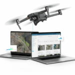
DroneDeploy's Groundbreaking Survey Reveals Rapid Growth, ROI Insights, and Optimistic Projections in Reality Capture Technology by DRONELIFE Staff Writer Ian J. McNabb In recent years, reality capture and photogrammetry have been rapidly gaining traction. Accurate mapping and data capture are crucial across various industries like construction, agriculture, and … [Read more...] about DroneDeploy on the State of Reality Capture: Trends, Adoption, and Future Prospects
photogrammetry
Revolutionizing 3D Mapping: SimActive’s Integration with Multi-Camera Drone Payloads
SimActive Enhances 3D Mapping with Multi-Camera Drone Payloads SimActive Inc., a global leader in photogrammetry software development, has announced the integration of its Correlator3D™ product with multi-camera drone payloads to enhance 3D mapping capabilities. This innovative software allows users to import configurations from both oblique and nadir cameras, paving the way … [Read more...] about Revolutionizing 3D Mapping: SimActive’s Integration with Multi-Camera Drone Payloads
Affordable Mapping Revolution: AerologixMaps Empowers Drone Businesses
AerologixMaps: Affordable, Scalable Mapping Software In the rapidly evolving world of drone technology, a new mapping solution is filling a gap in the market for small and medium size drone businesses. AerologixMaps, developed by Australian drone industry pioneer Aerologix, is transforming drone footage into high-resolution maps with unprecedented affordability. With … [Read more...] about Affordable Mapping Revolution: AerologixMaps Empowers Drone Businesses
SimActive Enhances Cloud Productivity with Correlator3D Upgrade
Latest SimActive Upgrade of Correlator3D™ Boosts Cloud Capabilities for Enhanced Productivity SimActive Inc., a global leader in photogrammetry software development, has announced significant enhancements to its Correlator3D™ software, aimed at improving productivity in cloud environments. The upgrade allows clients to effortlessly scale their processing in alignment with … [Read more...] about SimActive Enhances Cloud Productivity with Correlator3D Upgrade
ALDOT Uses Drone Data and Correlator3D for Rapid Tornado Recovery
ALDOT Employs SimActive Software and Drone Imagery for Swift Tornado Recovery In the wake of a devastating tornado that swept through the southwest portion of Selma, Alabama, earlier this year, the Alabama Department of Transportation (ALDOT) turned to SimActive Inc., a renowned developer of photogrammetry software, to aid in the efficient assessment of the damage. Utilizing … [Read more...] about ALDOT Uses Drone Data and Correlator3D for Rapid Tornado Recovery


