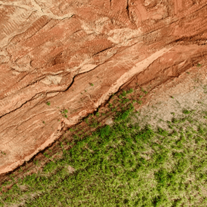
Drone mapping technology has advanced significantly in recent years, with Real-Time Kinematic (RTK) and Post-Processed Kinematic (PPK) positioning emerging as game-changing technologies. These methods enhance mapping accuracy and efficiency, reducing reliance on traditional Ground Control Points (GCPs). SimActive, a leading provider of photogrammetry software, offers powerful … [Read more...] about Enhancing Drone Mapping with RTK and PPK: Insights from SimActive’s Eric Andelin
photogrammetry
Global Mapper v26.1 Enhances AI-Based Tools and User Experience

New Update Introduces Deep Learning Model Fine-Tuning and Improved Point Cloud Processing Blue Marble Geographics has released Global Mapper v26.1, introducing enhancements to its geographic information system (GIS) software. This update refines point cloud processing, expands deep learning capabilities, and improves customization options for users. Global Mapper is … [Read more...] about Global Mapper v26.1 Enhances AI-Based Tools and User Experience
Drones Aid Disaster Recovery: Mapping and Photogrammetry Support Hurricane Helene Relief Efforts
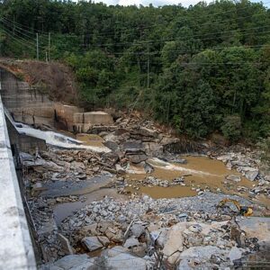
Drone mapping, photogrammetry aid recovery in wake of Helene devastation By DRONELIFE Features Editor Jim Magill (Part of a series on the drone community’s response to natural disasters) Hurricane Helene, the massive and deadly storm that tore through a large swath of the U.S. Southeast in late September, triggered a tremendous response from the drone-flying community, as … [Read more...] about Drones Aid Disaster Recovery: Mapping and Photogrammetry Support Hurricane Helene Relief Efforts
FlytBase and Pix4D Partner to Streamline Drone Data Processing Workflows
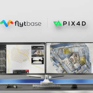
Integration Simplifies Project Management for Automated Drone Operations FlytBase, a drone autonomy software platform, has announced a strategic partnership with Pix4D, a leading photogrammetry platform for terrestrial and drone mapping. This collaboration aims to streamline drone data processing workflows by allowing FlytBase users to seamlessly upload their drone-captured … [Read more...] about FlytBase and Pix4D Partner to Streamline Drone Data Processing Workflows
INTERGEO 2024: World’s Largest Geoinformation and Land Management Conference

Join Us at Messe Stuttgart, September 24-26, for Three Days of Cutting-Edge Exhibitions, Lectures, and Networking Opportunities with a Special Focus on Drone Technology at the Unmanned Systems Stage Germany’s own INTERGEO, the world’s largest geoinformation and land management conference, has begun ticket sales for its arrival at Messe Stuttgart in the eponymous capital of … [Read more...] about INTERGEO 2024: World’s Largest Geoinformation and Land Management Conference


