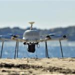
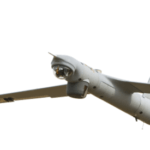
The drone industry is still in the early stages of growth, but it seems to have progressed past the very first phase of bleeding edge technology and to be moving - rapidly - towards proven solution. As enterprises ramp up adoption of drone technology, drone manufacturers who started selling in the military space are moving to meet them. The shift isn't as big as it might … [Read more...] about 3 Military Technologies Moving into Enterprise: Where You’ll See Them Next
Insitu
ViDAR Enables Unmanned Large Area Searches at Sea
Insitu, a manufacturer of UAS for civil and umanned use, has developed a new technology for providing greater maritime search capability for their ScanEagle product. The technology dubbed ViDAR (Video Detection and Ranging) was engineered in collaboration with Hood Technology and Sentient Vision Systems. ViDAR enables wide-area open-ocean searches that have historically … [Read more...] about ViDAR Enables Unmanned Large Area Searches at Sea
New Propulsion System Delivered for Insitu ScanEagle
from unmanned-aerial.com Perth, Australia-based Orbital Corp. Ltd. has delivered what it says is the first purpose-built ScanEagle unmanned aerial vehicle (UAV) propulsion system to Insitu Inc., a subsidiary of The Boeing Co., for in-house testing and development. Designed specifically for small unmanned aerial systems (sUAS)-class UAVs, it is the first reciprocating … [Read more...] about New Propulsion System Delivered for Insitu ScanEagle
8 Drone Makers Target Sustainability
from greenbiz.com Unmanned aerial vehicles — or drones — are associated mostly with military operations in remote parts of the world. That’s not surprising, considering their far-reaching impact in the global theater of war. But like many technologies originally developed for defense — such as jet engines, the Internet and GPS — the possibilities for drones also go well … [Read more...] about 8 Drone Makers Target Sustainability
Drones in Mudslide Relief Effort
Recovery officials for the Oso, WA mudslide brought in teams from Insitu, Texas A&M Engineering Experiment Station and PrecisionHawk, to survey areas of the disaster site that could not be examined through conventional means. Thanks to the PrecisionMapper software provided by PrecisionHawk, the teams had been able to take 48 minutes worth of drone flight recorded video … [Read more...] about Drones in Mudslide Relief Effort


