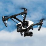
New data from Skywatch.ai, drone indsutry insurtech experts, indicate some early shifts in commercial drone market share. The commercial drone market has changed dramatically since the FAA issued its first comercial permit in 2006, points out Skywatch Head of Marketing Ilan Yusim. From their unique position in the industry, Skywatch gathered data from policies issues across … [Read more...] about Drone Market Share: What’s Changed in the Race Between DJI, Autel, and Skydio?
drone data
Skyward and Pix4D: Integrating Drone Management Platform with Drone Mapping
Skyward and Pix4D have announced that the drone management platform will now offer drone mapping and modeling powered by Pix4D, called Skyward Mapping and Modeling. It's a great move for both companies, moving another step closer to a seamless, end to end solution for enterprise customers. The Skyward platform allows customers to manage their drone program - from aircraft … [Read more...] about Skyward and Pix4D: Integrating Drone Management Platform with Drone Mapping
Dual Sensor Technology: Visual Intelligence and ARE Partner to Deliver Millimeter-Class Drone Data
Visual Intelligence provides patented dual sensor technology combined with software and analytics to deliver millimeter-class drone data. Now, through a new partnership, inspection specialists ARE will deliver rail and utility engineering services based on the newly enabled solution. There is no doubt that drone technology has become an important tool for infrastructure … [Read more...] about Dual Sensor Technology: Visual Intelligence and ARE Partner to Deliver Millimeter-Class Drone Data
Mapping and LiDAR: SimActive Integrated with LiDAR Solution for Drones
Drone-based mapping and LiDAR are a powerful combination. Now, Canada's SimActive Inc., a leading developer of photogrammetry software that can accommodate aerial imagery from satellite, manned aircraft, or drones, announces the integration of its Correlator3D™ product into LiDAR systems for drones developed by LiDAR USA. LiDARUSA, also known as Fagerman Technologies, is a … [Read more...] about Mapping and LiDAR: SimActive Integrated with LiDAR Solution for Drones
Data Privacy for DJI Drones: Expanded Protections for Government and Commercial Drone Operators
Amid ongoing trade tensions between China and the U.S. that has led to concerns about data privacy for DJI drones, DJI continues to enhance the security of their platform. Today, DJI announced that they would make Local Data Mode - a feature that eliminates entirely the need for internet connectivity, completely preventing the transmission of data over the internet - … [Read more...] about Data Privacy for DJI Drones: Expanded Protections for Government and Commercial Drone Operators


