For more than two decades, SimActive has been a constant presence in the evolution of drone mapping. Long before drones became commonplace in defense, surveying, or emergency response, the company was pushing the boundaries of photogrammetry for military clients with what is now known as Correlator3D, its flagship software platform. Today, as the drone industry accelerates … [Read more...] about Drone Mapping in 2026: What’s Driving the Next Era
drone data processing
When the Cloud Falters: What the AWS Outage Reveals About Drone Industry Dependencies

“When a major cloud provider sneezes, the Internet catches a cold.” — Mike Chapple, Professor of Cybersecurity, University of Notre Dame said in a CNBC interview A global AWS disruption highlights how deeply drone operations rely on cloud infrastructure and why resilience matters Amazon Web Services experienced a widespread outage this week that interrupted access to millions … [Read more...] about When the Cloud Falters: What the AWS Outage Reveals About Drone Industry Dependencies
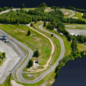
Managing Large Photogrammetry Projects Simultaneously: Can It Be Done?

How scalable workflows, automation, and distributed processing make managing large photogrammetry projects possible. DRONELIFE spoke with Philippe Simard, co-founder and CEO of SimActive, the Canadian company behind the Correlator3D photogrammetry suite, to explore one of the most pressing challenges in the aerial mapping industry: how to efficiently manage and process … [Read more...] about Managing Large Photogrammetry Projects Simultaneously: Can It Be Done?
DJI Terra 3D Modeling Software Now with 3D Gaussian Splatting – What’s That?

Next-gen reconstruction tech delivers faster, more accurate 3D modeling for large-scale and complex environments DJI Terra: A Powerful Tool for Aerial Data Processing DJI has expanded the capabilities of its Terra 3D modeling software with new reconstruction technologies, including 3D Gaussian Splatting. DJI Terra is designed to create accurate and detailed 2D and 3D models … [Read more...] about DJI Terra 3D Modeling Software Now with 3D Gaussian Splatting – What’s That?
SimActive’s Correlator3D Speeds Up Processing of Large Drone Datasets for SurvTech

Advanced photogrammetry software supports rapid delivery of high-quality geospatial products SimActive Inc., a global developer of photogrammetry software, has announced that SurvTech Solutions is using its Correlator3D product to process large-scale image datasets from drones and large-format cameras. The software enables SurvTech to deliver digital surface models and … [Read more...] about SimActive’s Correlator3D Speeds Up Processing of Large Drone Datasets for SurvTech


