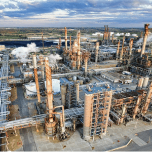
Correlator3D and Phase One Cameras Support Large-Scale Mapping Operations SimActive Inc.’s Correlator3D software is being used by Air Data Solutions (ADS) to map large oil and gas operations in South Texas. By integrating Phase One camera systems, ADS captures thousands of high-resolution images annually to produce detailed digital maps. Streamlining Aerial Mapping with … [Read more...] about SimActive and Air Data Solutions Enhance Oil & Gas Mapping with High-Resolution Aerial Imagery
digital surface models
SimActive Enhances Correlator3D with Multi-Camera System Compatibility
New Features to Boost Precision Mapping in Agriculture, Resource Management, and Construction Montreal-based photogrammetry software developers SimActive recently announced that its Correlator3D™ end-to-end software platform has added compatibility with multi-camera systems, allowing for a wider range of photogrammetry products. The additional sensors include oblique, … [Read more...] about SimActive Enhances Correlator3D with Multi-Camera System Compatibility


